This item has been sold, but you can get on the Waitlist to be notified if another example becomes available, or purchase a digital scan.

1852 Shields Wall Map of Boston and Vicinity

Boston-shields-1852
$1,100.00
Map of the City and Vicinity of Boston, Massachusetts. - Main View
Processing...

1852 Shields Wall Map of Boston and Vicinity

Boston-shields-1852


Title


Map of the City and Vicinity of Boston, Massachusetts.
  1852 (dated)     40 x 41 in (101.6 x 104.14 cm)

Description


An extremely scarce and dramatic 1852 wall map of Boston, Massachusetts and vicinity. Depicts the greater Boston area from Dover in the southwest to part of Concord in the northwest to Hingham southeast and to Danvers northeast. Includes all of Brookline, Newton and Waltham and much of Weston and Needham. The names of various families and landholders are indicated throughout with the exception of Boston proper. Based upon original surveys by F.G. Sidney. Highly decorative green border features engraved views of the Boston State House and Faneuil Hall. Full restoration. Original rollers.

Cartographer


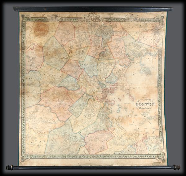
J. B. Shields (fl. c. 1850 - 1854) was a Boston based book and map publisher active in the mid-19th century. From their offices at 19 Hanover Street, Boston, the J. B. Shields firm published numerous maps and books, most of which were of a technical nature. More by this mapmaker...

Condition


Good. Full professional restoration and cleaning. Rebacked on new linen with new edging. Original rollers. Minor spotting and discoloration here and there. Overall age toning. Like most 19th century wall maps, it shows its age, but retains its character as a stunning and dramatic map.

References


Phillips. Maps of America, p. 157; Rumsey 5465.000.