1747 Bowen Map of England and Wales
EnglandWales-bowen-1747$650.00

Title
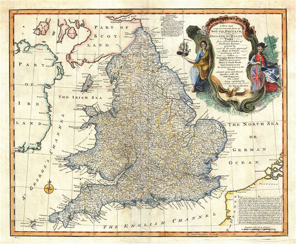
A New and very Accurate Map of South Britain, or England and Wales.
1747 (undated) 14.5 x 17.5 in (36.83 x 44.45 cm) 1 : 2170000
1747 (undated) 14.5 x 17.5 in (36.83 x 44.45 cm) 1 : 2170000
Description
This is a beautiful 1747 map of South Britain, or England and Wales, drawn by the British cartographer Emanuel Bowen. It depicts the entirety of England and Wales, including the Isle of Man. The map is extremely detailed, noting cities, boroughs, marketplaces, counties, etc. Roads are noted with distances between towns. River systems are well delineated and forests and topography and rendered in profile. A note in the bottom right quadrant of the map explains the compilation of the map. A beautifully illustrated title cartouche is included in the upper right quadrant. This map was prepares by Emanuel Bowen as plate no. 7 for the 1747 issue of A Complete System of Geography.
Cartographer
Emanuel Bowen (1694 - May 8, 1767) had the high distinction to be named Royal Mapmaker to both to King George II of England and Louis XV of France. Bowen was born in Talley, Carmarthen, Wales, to a distinguished but not noble family. He apprenticed to Charles Price, Merchant Taylor, from 1709. He was admitted to the Merchant Taylors Livery Company on October 3, 1716, but had been active in London from about 1714. A early as 1726 he was noted as one of the leading London engravers. Bowen is highly regarded for producing some of the largest, most detailed, most accurate and most attractive maps of his era. He is known to have worked with most British cartographic figures of the period including Herman Moll and John Owen. Among his multiple apprentices, the most notable were Thomas Kitchin, Thomas Jeffreys, and John Lodge. Another apprentice, John Oakman (1748 - 1793) who had an affair with and eventually married, Bowen's daughter. Other Bowen apprentices include Thomas Buss, John Pryer, Samuel Lyne, his son Thomas Bowen, and William Fowler. Despite achieving peer respect, renown, and royal patronage, Bowen, like many cartographers, died in poverty. Upon Emanuel Bowen's death, his cartographic work was taken over by his son, Thomas Bowen (1733 - 1790) who also died in poverty. More by this mapmaker...
Source
Bowen, E., A complete system of geography. Being a description of all the countries, islands, cities, chief towns, harbours, lakes, and rivers, mountains, mines, etc., of the known world …, (London) 1747.
Condition
Very good. Minor wear and toning along original centerfold. Original platemark visible. Wormholes at two places near centerfold top and bottom.
References
Rumsey 3733.006. Philips (atlases) 614 (1752 edition).