This item has been sold, but you can get on the Waitlist to be notified if another example becomes available, or purchase a digital scan.

1852 Duvotenay Map of the United States (Gold Rush)

EtatsUnis-duvotenay-1852
$137.50
Etats-Unis par Th. Duvotenay. - Main View
Processing...

1852 Duvotenay Map of the United States (Gold Rush)

EtatsUnis-duvotenay-1852


Title


Etats-Unis par Th. Duvotenay.
  1852 (undated)     9 x 12.5 in (22.86 x 31.75 cm)

Description


An uncommon and extremely attractive 1852 map of the United States by Th. Dovotenay. Depicts the United States at the height of the California Gold Rush and shortly after the annexation of Texas. While most of the eastern United States is well defined the territories of the transmississippi west are somewhat vague. California is shown as the large territory ceded by Mexico in 1849. The gold region along the Sacramento River is colored yellow and notated. Nouveau-Mexique (New Mexico) appears on the map in a very early state with its capital at Santa Fe. Encompassing much of the territory that is traditionally included as part of the c. 1850 Texas, especially the northern extension along the Green River; it is bounded on the west by the Rocky Mountains, the north by the Arkansas River and the east by Texas along the line established by the Adams-Onis treaty of 1819. Texas appears in an unusual configuration separated its c. 1850 western properties by the Adams-Onis treaty line. To the north of Nouveau-Mexique and Texas, Several American Indian territories are shows including the District des Mandanes, the District des Osages, the District d'Ozark, and the District Des Sioux. Labels the Great Salt Lake as Lake Teguayo after José Antonio de Alzate y Ramírez. Lake Teguayo is said by some to be the legendary homeland of the Aztecs. To the north of Lake Teguayo, today's Lake Utah is labeled Lake Timpanogos. Features a beautiful frame style border. Prepared by Th. Duvotenay for publication as plate no. 30 in Maison Basset's 1852 edition of the Atlas Illustre.

CartographerS


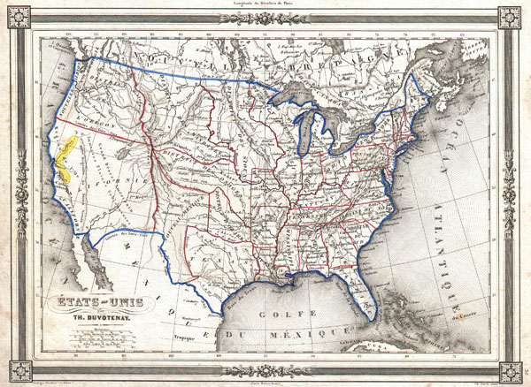
Thunot Duvotenay (1796 - 1875) was a French geographer active in the mid 19th century. Thunot is known to have worked with several other important cartographers of his dayincluding Barbie du Bocage, Vuillemin, Charle, Levassseur and Dufour. More by this mapmaker...


Maison Basset (1819 - 1865) was a French publishing concern active through the mid to late 19th century. The firm can trace their roots to André Basset (or Bassett) (fl. 1768 - 1784), who starting publishing maps, prints, and books around 1768. Maison Basset, also Chez Basset, is the imprint under which the heirs of Paul-André Basset (1785 - 1819) operated after his death. From their offices at 64 Rue St. Jacques, then 33 Rue de Seine, Paris, France, Maison Basset published the works of such prominent French cartographers and engravers as Barbie du Bocage, A. Vuillemin, J. B. Charle, V. Levasseur, Tu. Duvotenay, H. Dufor, F. E. George, and others. Their library of publications is diverse and vast, but heavily focused on medical and scientific texts, including several important atlases. Learn More...

Source


Maison Basset, Atlas Illustre, (1852 issue).    

Condition


Very good condition. Some marginal foxing, else clean. Blank on verso.