This item has been sold, but you can get on the Waitlist to be notified if another example becomes available, or purchase a digital scan.

1952 Hagstrom Map of Florida

FloridaSilverSprings-hagstrom-1952
$150.00
America's Finest Highways Lead to Florida's Silver Springs. - Main View
Processing...

1952 Hagstrom Map of Florida

FloridaSilverSprings-hagstrom-1952

Silver Springs - the largest tourist attractions in Florida in the 1950s.

Title


America's Finest Highways Lead to Florida's Silver Springs.
  1952 (dated)     17.75 x 24 in (45.085 x 60.96 cm)     1 : 1267200

Description


This is a 1952 Hagstrom map of Florida. Created as a promotional piece for Silver Springs, a tourist attraction outside Ocala, Florida, a large red 'arrow' emphasizes Silver Springs' location in central Florida. U.S. highways are illustrated in red and four highways pass through Ocala, highlighting how easy it would be for travelers to stop at Silver Springs on their way to their final destination or on their way home. Gorgeous color photographs increase Silver Springs' appeal and promote its crystal-clear water, glass-bottom boats, reptile house, and its rhesus macaques. Throughout the 1930s and 1940s, billboards and other advertisements appeared along highways around the country proclaiming the wonders found at Silver Springs, pointing the way, and telling motorists just how far it was from where they were to this paradise. By the 1950s, Silver Springs was the largest tourist attraction in Florida. Today, the 'attraction' is now part of Silver Springs State Park, but the glass-bottom boats (and the slightly dangerous monkeys) still beckon thousands of visitors every year. A wonderful pictorial border, consisting of illustrations of fish, a woman swimming, and a glass-bottom boat, surrounds the entire map. Five maps on the verso detail the highway connections between locations throughout the United States and Silver Springs.
Publication History and Census
This map was created by the Hagstrom Company and published by Ray, Davidson, and Ray (the owners of Silver Springs) in 1952. We have been unable to locate any other surviving examples of the present map.

Cartographer


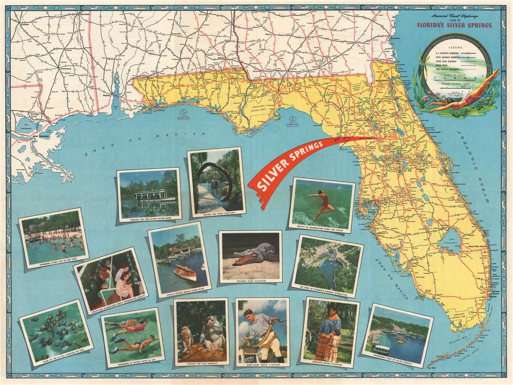
Andrew Gunnar Hagstrom (1890 - September 24, 1977) was a map publisher based in Maspeth, Queens. Hagstrom was a Swedish immigrant who came to new York in 1909 where took work milking cows at a farm near Coney Island, Brooklyn. He then worked in the meat packing industry while taking a degree in commercial art at the New York Mechanics Institute. Afterwords he founded a drafting business in Manhattan, creating a map to illustrate his drafting skill help customers locate his shop. His map proved popular and he expanded operations, founding the Hagstrom Map Company (1916 - 1968) and issuing additional maps of various parts of New York City and the surrounding regions. By 1949, Hagstrom had issued more than 150 maps, guides, and atlases, most of which focused on New York. Hagstrom pioneered a cartographic style that exaggerated street size to increase clarity and create additional room for large print readable labeling. Even the New York Subway system hired Hagstrom to produce its map, which was in use from the 1940s to 1958. Hagstrom died in 1977, at the age of 81. Hagstrom was knighted by the King of Sweden. His company flourished until 1968 when it was acquired by Macmillan. The brand has since passed through multiple corporate portfolios and is currently the property by Kappa Publishing Group. More by this mapmaker...

Condition


Very good. Exhibits light wear along original fold lines. Exhibits some toning. Road maps on verso.