
Hagstrom, Andrew Gunnar

Andrew Gunnar Hagstrom (1890 - September 24, 1977) was a map publisher based in Maspeth, Queens. Hagstrom was a Swedish immigrant who came to new York in 1909 where took work milking cows at a farm near Coney Island, Brooklyn. He then worked in the meat packing industry while taking a degree in commercial art at the New York Mechanics Institute. Afterwords he founded a drafting business in Manhattan, creating a map to illustrate his drafting skill help customers locate his shop. His map proved popular and he expanded operations, founding the Hagstrom Map Company (1916 - 1968) and issuing additional maps of various parts of New York City and the surrounding regions. By 1949, Hagstrom had issued more than 150 maps, guides, and atlases, most of which focused on New York. Hagstrom pioneered a cartographic style that exaggerated street size to increase clarity and create additional room for large print readable labeling. Even the New York Subway system hired Hagstrom to produce its map, which was in use from the 1940s to 1958. Hagstrom died in 1977, at the age of 81. Hagstrom was knighted by the King of Sweden. His company flourished until 1968 when it was acquired by Macmillan. The brand has since passed through multiple corporate portfolios and is currently the property by Kappa Publishing Group.
Railroad network in Jersey City and Hoboken.
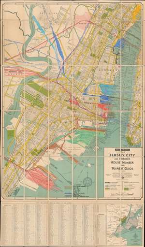
Hagstrom's Map of Jersey City and Hoboken House Number and Transit Guide Map No. 2200A
$800.00
Acquire
- Digital Map Information
- Suitable for large format printing
- File Size: 54.6 MB
- File Type: ZIP / TIFF
- ICC color profile embedded
- Delivered instantly via download link
This is a c. 1939 Hagstrom city plan or map of Jersey City and Hoboken, New Jersey, featuring manuscript notations highlighting the region's railroad network. The map depicts from the Pennsylvania Railroad freight terminal west of the Hackensack River to the western side of Manhattan and the Battery and from Union City to Bayonne. Streets are illustrated throughout, including the Lincoln Tunnel and the Holland Tunnel, with city parks, fields, and water reservoirs also labeled. Roosevelt Field, opened in 1937, was home to the minor league baseball team the Jersey City Giants. A street index for Jersey City and Hoboken is included below the bottom border, along with a small map of Hudson County and the vicinity. (more details)
Mr. Moses' Bridges - Both Real and Imagined.
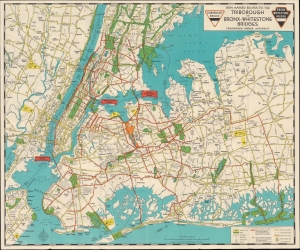
Sign marked Routes to the Triborough and Bronx-Whitestone Bridges / Triborough Bridge Authority Traffic Crossings Linking the Boroughs of Manhattan, Bronx and Queens.
$450.00
Acquire
- Digital Map Information
- Suitable for large format printing
- Full resolution TIFF file
- ICC color profile embedded
- Delivered instantly via download link
This engrossing c. 1939 folding map of New York City was prepared by local cartographic firm Hagstrom for the Triborough Bridge Authority. Meant primarily to inform motorists, it also serves as a celebration of the vision of urban planner and highway enthusiast Robert Moses. At the same time, the map chronicles one of Moses' rare defeats, the never-built 'Battery-Brooklyn Bridge.' (more details)
Lake Champlain by ferry!
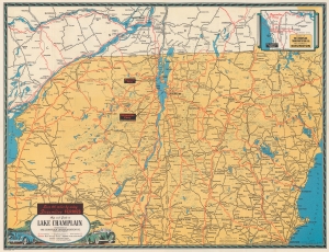
Map and Guide to Lake Champlain.
$250.00
Acquire
- Digital Map Information
- Suitable for large format printing
- Full resolution TIFF file
- ICC color profile embedded
- Delivered instantly via download link
A tourist map published during World War II, this is a 1940 Hagstrom map of Lake Champlain, New York, Vermont, and New Hampshire distributed by the Champlain Transportation Company, which operated steamships on Lake Champlain. (more details)
Highlights Manhattan's many theatres, including the New Amsterdam and Lyric Theatres.
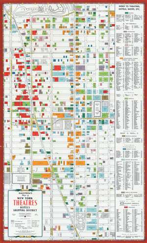
Hagstrom's Map of New York Theatres, Hotels, Shopping District.
$400.00
Acquire
- Digital Map Information
- Suitable for large format printing
- File Size: 27.38 MB
- File Type: ZIP / TIFF
- ICC color profile embedded
- Delivered instantly via download link
This is a c. 1940 Hagstrom map of Midtown Manhattan highlighting the Theatre District and its many theatres. The map depicts the city from Eighth Avenue to Lexington Avenue and from West 61st Street, Central Park, and East 61st Street to 22nd Street. Although numerous buildings are illustrated, not all the city blocks are filled. Banks, churches, clubs, department stores, hotels, nightclubs, office buildings, public buildings, train stations, and theatres are shaded using various colors to allow for easy differentiation and identification. An index, situated along the map's right side, lists the identified locations, offers a color-coding key, and notes each building's coordinates on the map. (more details)
Mapping New York Nightlife.
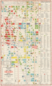
Hagstrom's Map of New York Theatres, Hotels, Shopping District.
$400.00
Acquire
- Digital Map Information
- Suitable for large format printing
- File Size: 23.07 MB
- File Type: ZIP / TIFF
- ICC color profile embedded
- Delivered instantly via download link
This is a 1943 Hagstrom map of Midtown Manhattan highlighting the city's iconic Theatre District. This particular example bears advertising for the real estate firm Cushman and Wakefield. (more details)
Visual celebration of American folk music.
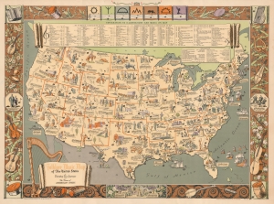
Folklore Music Map of the United States.
$1,200.00
Acquire
- Digital Map Information
- Suitable for large format printing
- File Size: 43.67 MB
- File Type: ZIP / TIFF
- ICC color profile embedded
- Delivered instantly via download link
This is a 1946 Dorothea Dix Lawrence and Harry Cimino pictorial folklore music map of the United States. The map is a visual celebration of American folk music. It was compiled by opera singer turned folklorist Dorothea Dix Lawrence from her 'Primer of American Music' radio program. The map is part of her efforts to broadly collect and disseminate music in America. (more details)
Early Postwar Brooklyn
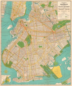
Hagstrom's Map of Brooklyn New York City House Number and Transit Guide. / Hagstrom's Map of Brooklyn New York.
$300.00
Acquire
- Digital Map Information
- Suitable for large format printing
- Full resolution TIFF file
- ICC color profile embedded
- Delivered instantly via download link
This is a 1953 Hagstrom indexed city plan or map of Brooklyn, New York City, and the immediate vicinity. (more details)