
This item below is out of stock, but another example (left) is available. To view the available item, click "Details."
Details
1770 Delisle de Sales Map of the Retreat of the Ten Thousand Greeks
1770 (undated) $200.00
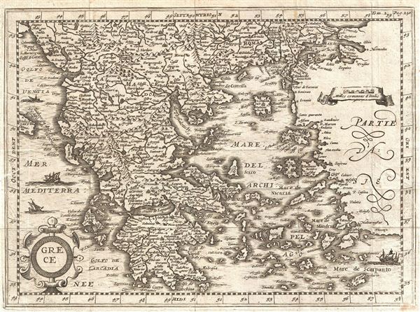
1700 Martineau Map of Greece
Grece-martineau-1700$125.00

Title
Grece.
1700 (undated) 8 x 10.5 in (20.32 x 26.67 cm)
1700 (undated) 8 x 10.5 in (20.32 x 26.67 cm)
Description
An uncommon early map of Greece issued for Martineau du Plessis in 1700. Centered on the Negroponte, this map covers from the Gulf of Venice to Asia Minor and From Romania and the Sea of Marmara to Morea. Beautifully details the many island and cities of Greece with three decorative sailing ships in the waters. Though most likely first drawn in the early 17th century, this edition was published with the 1700 edition of Martineau du Plessis' Nouvelle Geographie.
Martineau Du Plessis (fl. c. 1700) was a French geographer and schoolmaster from Fontenay, possibly Fontenay-le-Comte. He is best known for his multivolume geography, Nouvelle Geographie issued in 1700. Little else is known of his life. Learn More...
Source
Martineau du Plessis, Nouvelle Geographie, ou Description Exacte de l'Univers (George Gallet, Directeur de l'Imprimerie des Huguetan), vol 2, 1700.
Condition
Very good. Closed verso repair extending approximatly 1/2 inch from left center margin. Original fold lines. Blank on verso.
References
Bibliotheque Nationale de France: Réserve A 200 189