This item has been sold, but you can get on the Waitlist to be notified if another example becomes available, or purchase a digital scan.
1850 Public Survey Map of Indiana
IN-ls-1850$80.00

Title
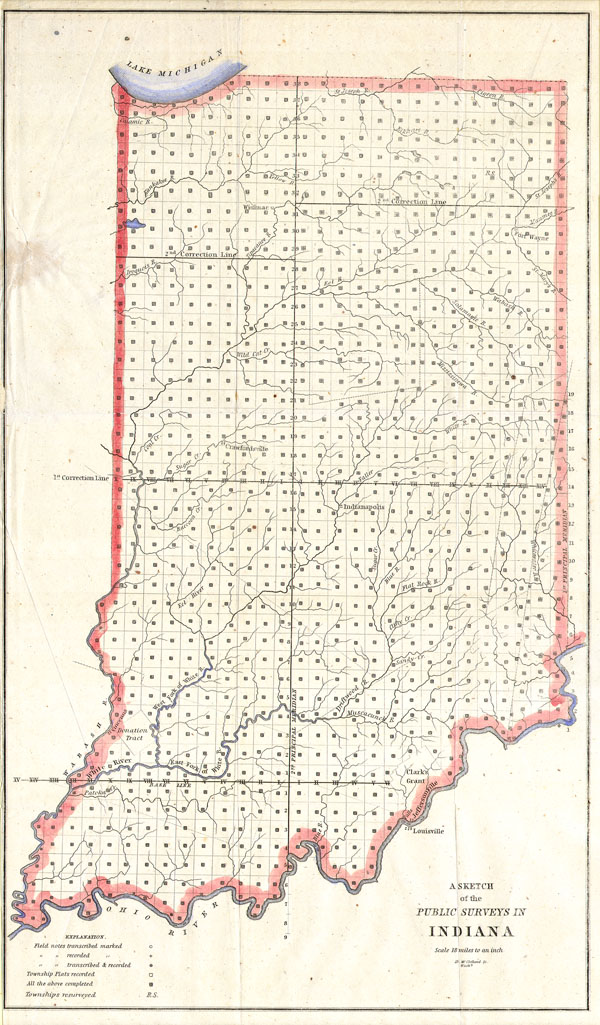
Sketch of the Public Survey’s in Indiana
1850 10 x 18 in (25.4 x 45.72 cm)
1850 10 x 18 in (25.4 x 45.72 cm)
Description
This magnificent map of Indiana was issued for the U.S. Land Survey Office under the supervision of D. Mc Clelland. It is officially entitled 'Sketch of the Public Survey's in Indiana.' In the southeast, near Louisville, Clark's Grant is labeled. This was the territory set aside by Thomas Jefferson for Virginia soldiers and officers who fought in the Revolutionary War. This large map reveals the state of Indiana in fair detail with special attention to rivers and waterways. An exceptional and rare early map of this region.
Cartographer
The General Land Office (1812 - 1946) was an independent agency charged with the administration and sale of public lands of the western territories of the United States under the Preemption Act of 1841 and the Homestead Act of 1862. During a time of frenetic energy and rapid westward expansion, the Land Office oversaw the surveying, platting, mapping and eventually the sale of much of the Western United States and Florida. The structural layout of the western United States that we see today, and many of their district and county divisions, are direct result of the early surveying work of the General Land Office. More importantly, as a branch of the Federal Government in Washington D.C. and the only agency able to legally sell and administer public lands in the western territories of the United States, the General Land Office played a pivotal role in consolidating power away from the original states and into the hands of the centralized federal government. The General Land Office was absorbed into the Department of Interior in 1849 and in 1946 merged with the United States Grazing Service to become the Bureau of Land Management. Today the Bureau of Land Management administers the roughly 246 million acres of public land remaining under federal ownership. More by this mapmaker...
Condition
Very good condition.