This item has been sold, but you can get on the Waitlist to be notified if another example becomes available, or purchase a digital scan.
1700 Martineau Map of Italy, Sicily, Sardinia, and Corsica
Italie-martineau-1700$125.00

Title
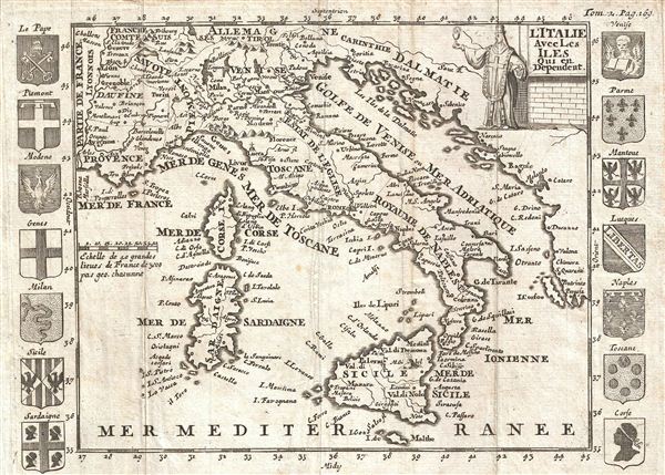
l'Italie Avec Les Iles qui en Dependent.
1700 (undated) 6.25 x 8.5 in (15.875 x 21.59 cm)
1700 (undated) 6.25 x 8.5 in (15.875 x 21.59 cm)
Description
An uncommon map of Italy issued in 1700. Centered on peninsular Italy, this map covers from Provence to Corfu and from Tyrol to Malta, inclusive of Corsica, Sardinia, and Sicily. The map is surrounded by sixteen armorial crests representing various Italian regions. A decorative title cartouche possibly representative of the Pope appears in the Upper right quadrant. Prepared for Martineau du Plessis' Nouvelle Geographie, published in 1700.
Cartographer
Martineau Du Plessis (fl. c. 1700) was a French geographer and schoolmaster from Fontenay, possibly Fontenay-le-Comte. He is best known for his multivolume geography, Nouvelle Geographie issued in 1700. Little else is known of his life. More by this mapmaker...
Source
Martineau du Plessis, Nouvelle Geographie, ou Description Exacte de l'Univers (George Gallet, Directeur de l'Imprimerie des Huguetan), vol 2, 1700.
Condition
Very good. Original fold lines. Blank on Verso.
References
Bibliotheque Nationale de France: Réserve A 200 189