This item has been sold, but you can get on the Waitlist to be notified if another example becomes available, or purchase a digital scan.
1730 Street Map or Plan of Jerusalem
Jerusalem-uk-1730$125.00

Title
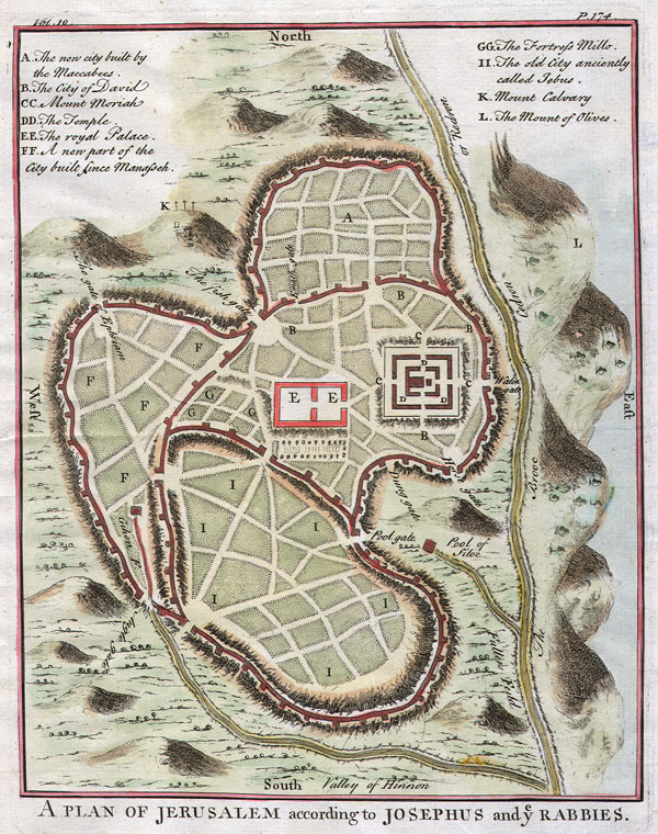
A Plan of Jerusalem according to Josephus and y Rabbies.
1730 8 x 11 in (20.32 x 27.94 cm)
1730 8 x 11 in (20.32 x 27.94 cm)
Description
This is a fascinating c. 1730 map of Jerusalem. Important buildings such as the Temple, Solomon's Palace, and the various quarters. The original gates are also labeled. To the east the Mount of Olives is depicted.
Condition
Fine or perfect condition. Wide margins. Original press mark visible. Blank on verso.