This item has been sold, but you can get on the Waitlist to be notified if another example becomes available, or purchase a digital scan.
1764 Gentleman's Magazine Map of London and Environs
London-gentsmag-1764$200.00

Title
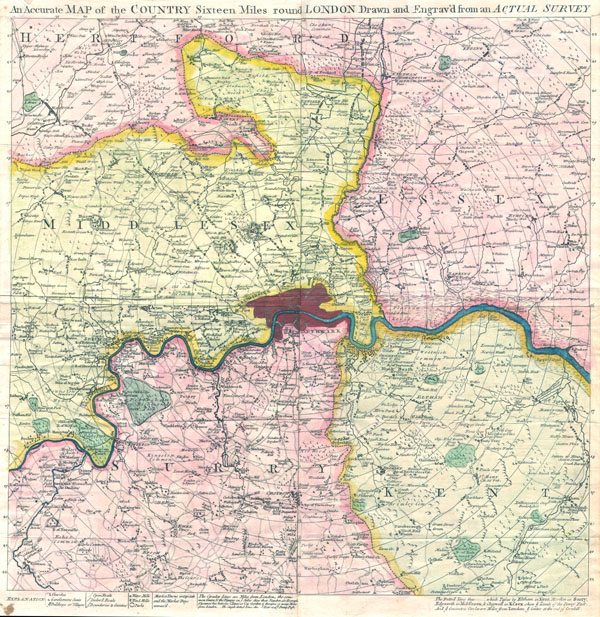
An Accurate Map of the Country Sixteen Miles Round London Drawn and Engrav'd from an Actual Survey.
1764 16 x 16 in (40.64 x 40.64 cm)
1764 16 x 16 in (40.64 x 40.64 cm)
Description
This is a rare and unusual c. 1764 Map of London, England and the environs sixteen miles around. Published by Gentleman's Magazine in four separate issues with publisher's instruction on how to bind them into a single map. Covers the London area in considerable detail with good references to churches, 'Gentlemen's Seats,' buildings villages, Water Mills and Wind mills. Altogether fascinating references show market towns and indicates the days when the markets are active – a practice common in rural areas but rarely seen in London today. A rare and wonderful insight into old-time London.
Cartographer
The Gentleman's Magazine (fl. c. 1731 - 1922) was an English periodical founded by visionary Edward Cave. Considered the world's first monthly general interest magazine, GM was also known as Trader's Monthly Intelligencer. Cave's innovation was to create a monthly digest of news and commentary on any topic the educated public might be interested in, from commodity prices to Latin poetry. It carried original content from a stable of regular contributors, as well as extensive quotes and extracts from other periodicals and books. Cave, who edited The Gentleman's Magazine under the pen name "Sylvanus Urban", was the first to use the term "magazine" (meaning "storehouse") for a periodical. The iconic illustration of St John's Gate on the front of each issue (occasionally updated over the years) depicted Cave's home, in effect, the magazine's "office". Among the important firsts of the The Gentleman's Magazine are the first use of the term "magazine" for a periodical and the first regular employment of lexicographer Samuel Johnson. More by this mapmaker...
Condition
Very good condition. Four sheets joined. Minor repair in upper left margin, above 'A' in 'Accurate'.
References
Jolly, David C., Maps in British Periodicals, GENT-176. Howgego, James L., Printed Maps of London circa 1553-1850, 103a.