This item has been sold, but you can get on the Waitlist to be notified if another example becomes available, or purchase a digital scan.
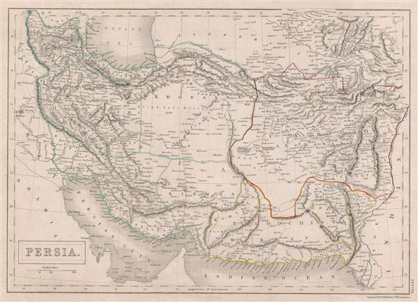
1840 Black Map of Persia and Afghanistan (Iran)
Persia-black-1840$75.00

Title
Persia
1840 (undated) 10.5 x 15 in (26.67 x 38.1 cm)
1840 (undated) 10.5 x 15 in (26.67 x 38.1 cm)
Description
A fine example of Adam and Charles Black's 1840 map of Persia. Set between the Caspian Sea and the Persian Gulf, this map covers all of modern day Iran and Afghanistan as well as parts of adjacent Pakistan, and Iraq. Persia at this time was controlled by the powerful Qajar Dynasty of Shahs. This map was engraved by S. Hall for issue in the 1840 edition of Black's General Atlas.
Cartographer
Charles and Adam Black (fl. 1807 - present) were map and book publishers based in Edinburgh. Charles and his uncle, Adam, both of Edinburgh, Scotland, founded their publishing firm in 1807. They published a series of maps and atlases throughout the 19th century. In addition to an array of atlases, the Black firm is known for their editions of the Encyclopedia Britannica (1817 - 1826) and the first publishing of Sir Walter Scott's novels in 1854. In 1889 the A. & C. Black publishing house moved to London where it remains in operation to this day. More by this mapmaker...
Source
Hall, Sydney, Black's General Atlas: A series of Fifty-Four Maps from the Latest and Most Authentic Sources, Engraved on Steel, In the First Style of the Art, (Edinburgh: Adam and Charles Black) 1840.
Condition
Good condition. Even overall toning. Blank on verso.
References
Philips (atlases) 4334. Alai, C., General Maps of Perisa 1477-1925, E278.