This item has been sold, but you can get on the Waitlist to be notified if another example becomes available, or purchase a digital scan.
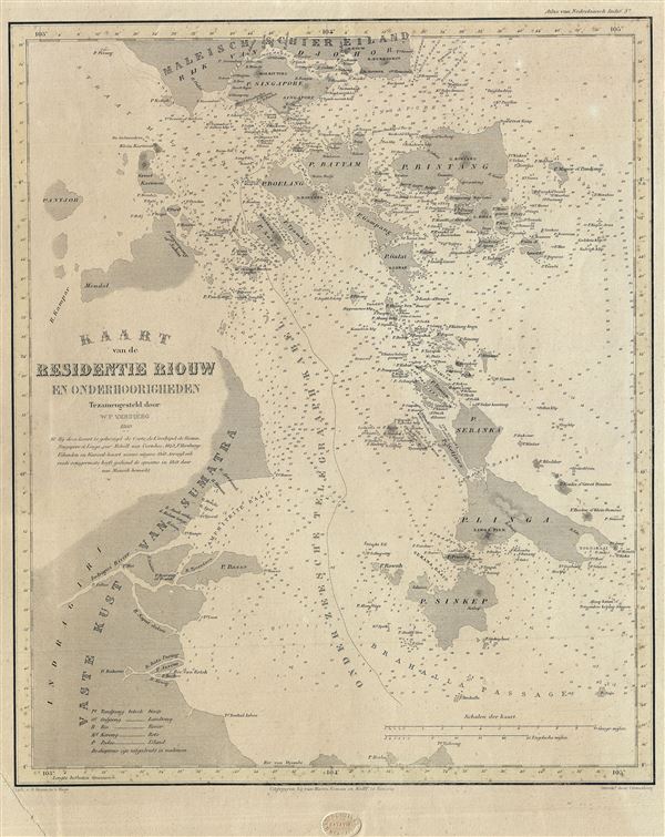
1860 Versteeg Map of the Riau Archipelago, Sumatra Indonesia (Including Malay and Singapore)
RiauIslands-versteeg-1860$250.00

Title
Kaart van de Residentie Riouw en Onderhoorigheden.
1860 (dated) 17 x 13.5 in (43.18 x 34.29 cm) 1 : 760000
1860 (dated) 17 x 13.5 in (43.18 x 34.29 cm) 1 : 760000
Description
This is a scarce and beautiful 1860 map of the Riau Island Province in Sumatra, Indonesia. The map covers from southern Malaysia and Johor Bahru to Singkep Island or Pulau Singkep of the Riau Islands. Includes the Riau Archipelago and the Island of Singapore. The map offers considerable detail throughout, noting several islands, cities, rivers, straits and other topographical features. It also notes countless depth soundings, offshore reefs and a wealth of other practical information useful for navigation. The underwater telegraph cable from Singapore is also noted. This map was published by van Haren Noman and Kolff, Batavia, for issue in P. Baron Melvill van Carnbee and W. F. Versteeg's Algemeene atlas van Nederlandsch Indie.
Source
Haren Noman en Kolff, Algemeene atlas van Nederlandsch Indie door P. Baron Melvill van Carnb´ee en W.F. Versteeg, Batavia.
Condition
Very good. Overall age toning. Margin extended over lower left corner.