This copy is copyright protected.
Copyright © 2024 Geographicus Rare Antique Maps
1967 Vietnamese Dan Chu Newspaper Map of the Six-Day War in the Middle East
SixDayWar-thaihung-1967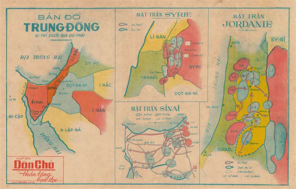

Copyright © 2024 Geographicus Rare Antique Maps | Geographicus Rare Antique Maps
This copy is copyright protected.
Copyright © 2024 Geographicus Rare Antique Maps