This item has been sold, but you can get on the Waitlist to be notified if another example becomes available, or purchase a digital scan.
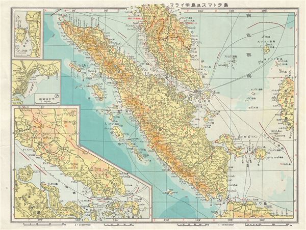
1943 Japanese World War II Era Map of Singapore, Malay and Sumatra, Indonesia
Sumatra-japanese-1943$50.00

Title
Malay and Sumatra.
1943 (undated) 11 x 14 in (27.94 x 35.56 cm) 1 : 6000000
1943 (undated) 11 x 14 in (27.94 x 35.56 cm) 1 : 6000000
Description
This is a scarce 1943 Japanese map of the Malay Peninsula (Malaysia) including Singapore and Sumatra, Indonesia, from the Great East Asia Atlas issued during World War II. The map covers the Malay Peninsula including Singapore as well as the island of Sumatra, Indonesia. This map was issued in 1943, after the capture of Malay and Sumatra by the Japanese Army. It offers superb detail regarding both topographical and political elements. Notes cities, railways, rivers, shipping lines, etc., and uses shading to display oceanic depths. Includes three insets along the left border. All text is in Japanese.
Condition
Very good. Minor wear along original centerfold. Blank on verso.