
This item below is out of stock, but another example (left) is available. To view the available item, click "Details."
Details
1964 U.S. Geological Survey Map of Yellowstone National Park
1964 (dated) $950.00
1871 Crofutt Map of the Yellowstone National Park
Yellowstone-crofutt-1871$50.00

Title
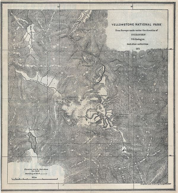
Yellowstone National Park.
1871 (dated) 10 x 9 in (25.4 x 22.86 cm) 1 : 80000
1871 (dated) 10 x 9 in (25.4 x 22.86 cm) 1 : 80000
Description
This is a fine 1871 geological map of the spectacular Yellowstone National Park, Wyoming issued by George A. Crofutt. Centered on Yellowstone Lake, the map covers the entire park as well as the adjacent parts of the Yellowstone Forest Reserve. Situated at over 7000 feet, Yellowstone Lake is the largest high altitude lake in the United States. Throughout countless well known Yellowstone sites are noted, including the Geyser Basin, Hot Springs, Elephants back, mountains, rivers, lakes, etc. The boundary line between Yellowstone National Park and Yellowstone Forest Reserve is also noted. The map is based on the surveys map under the direction of F. V. Hayden, U.S. Geologist and other authorities in 1871 and was issued as part of Crofutt's Trans-Continental Tourist's Guide.
Source
Crofutt, Geo. A., Crofutt's Trans-Continental Tourist Guide, (Fifth Volume) 1873.
Condition
Very good. Original fold lines visible. Professionally flattened and backed with archival tissue.