1985 Guimarin and MacEwen Manuscript Map of San Antonio, Texas, in 1855
1855SanAntonio-guimarin-1985$1,500.00


Title
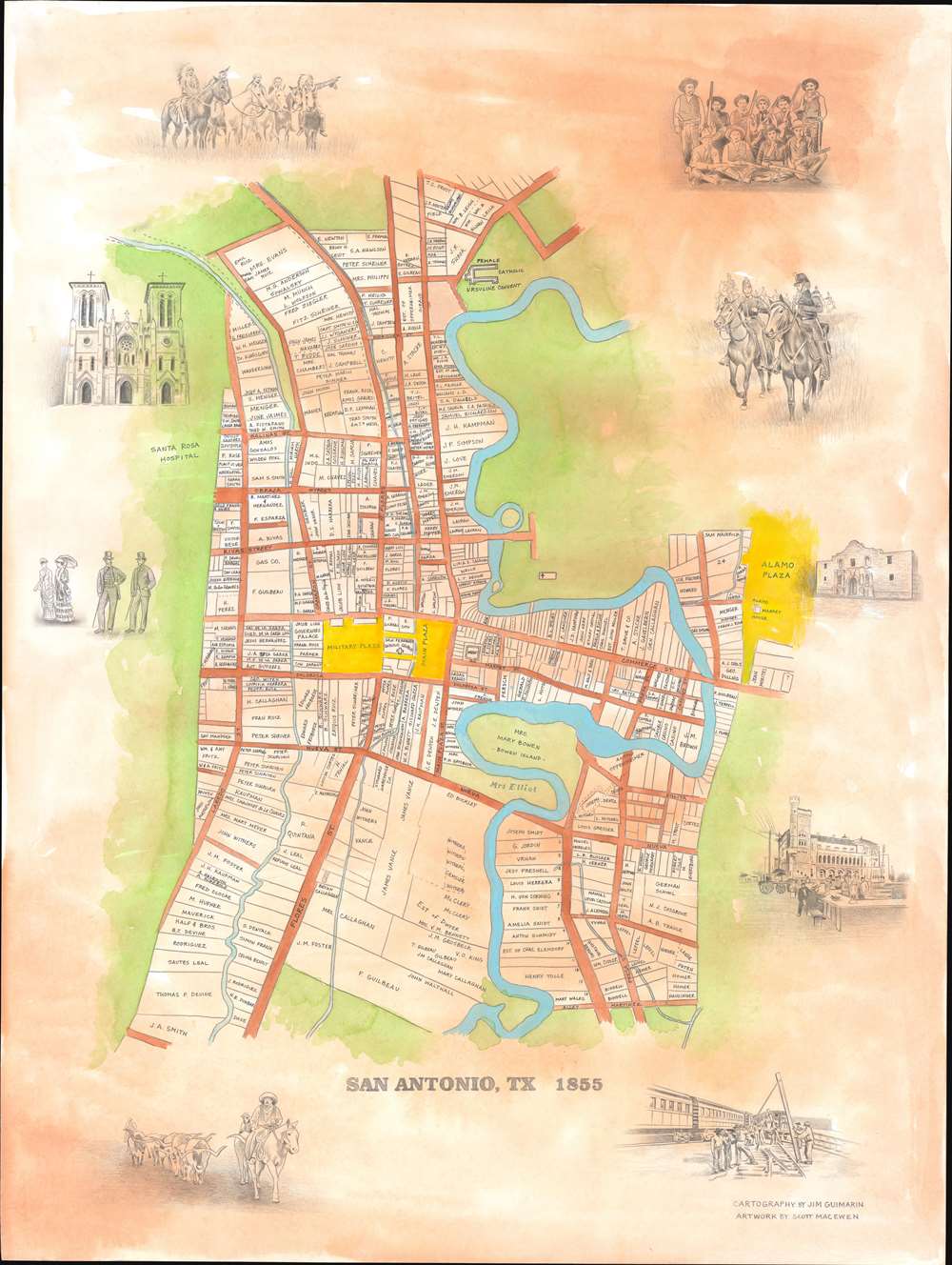
San Antonio, TX 1855.
1985 (undated) 30.25 x 40 in (76.835 x 101.6 cm) 1 : 2530
1985 (undated) 30.25 x 40 in (76.835 x 101.6 cm) 1 : 2530
Description
This is Jim Guimarin and Scott MacEwen's original manuscript artwork for their c. 1985 pictorial map of San Antonio, Texas. Depicting the city as it appeared in 1855, the map breaks down individual lots, labeling each with the landowner's name - evidence of the the mapmakers' meticulous scholarship. The Main Plaza, Military Plaza, and Alamo Plaza are highlighted in yellow. San Fernando Catholic Church, situated between the Military Plaza and the Main Plaza, is illustrated and labeled. The Governor's Palace, female Catholic Ursuline Convent, and the Alamo Market House are labeled as well. lustrations of The Alamo, San Fernando Catholic Church, soldiers, lawmen, and ranchers encircle the central map.
Publication History
This is a c. 1985 manuscript map with cartography by Jim Guimarin and artwork by Scott MacEwen. There are no other known examples, although we have been told that a few reduced versions were printed.Cartographer
James Donald 'Jim' Guimarin (June 11, 1934 - Present) is an American antique dealer who operated The History Shop in San Antonio, Texas. Guimarin closed his shop in 2016 to make way for the project to redevelop Alamo Plaza. More by this mapmaker...
Condition
Very good.