1945 Kaliher and White Set of Pictorial WWII Route Maps of 79th Inf. in Europe
79thInfantrySet-kaliherwhite-1945-2$2,200.00

Title
Through France with the 79th Infantry Division 14 June to 29 Aug, 1944. Maj Gen I.T. Wyche, Commanding. / To Belgium and Back wit the 79th Infantry Division 31 Aug to 25 Oct, 1944 Maj. Gen. I. T. Wyche, Commanding. / To the Rhine with the 79th Infantry Division 25 Oct to 14 Feb. 1945 Maj Gen I.T. Wyche, Commanding. / Over the Rhine with the 79th Infantry Division 17 Feb to 9 May 1945 Maj. Gen. I. T. Wyche, Commanding.
1945 (undated) 26 x 33 in (66.04 x 83.82 cm)
1945 (undated) 26 x 33 in (66.04 x 83.82 cm)
Description
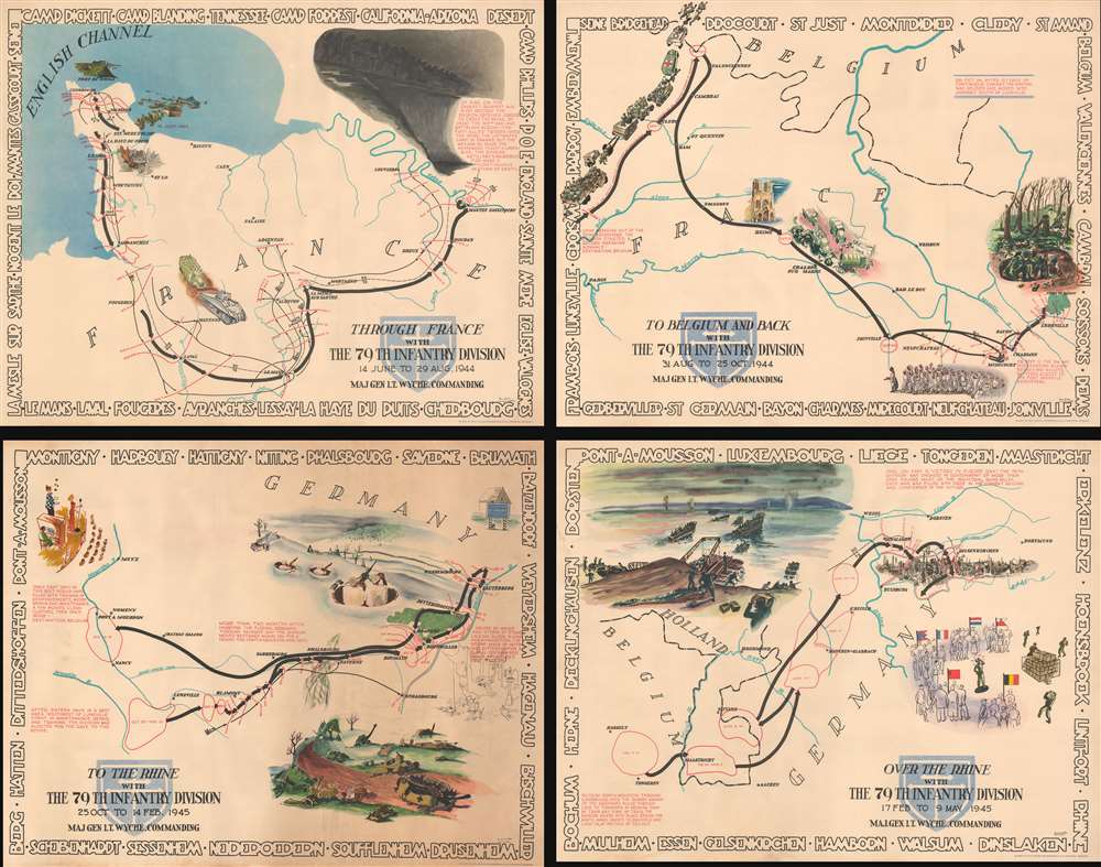
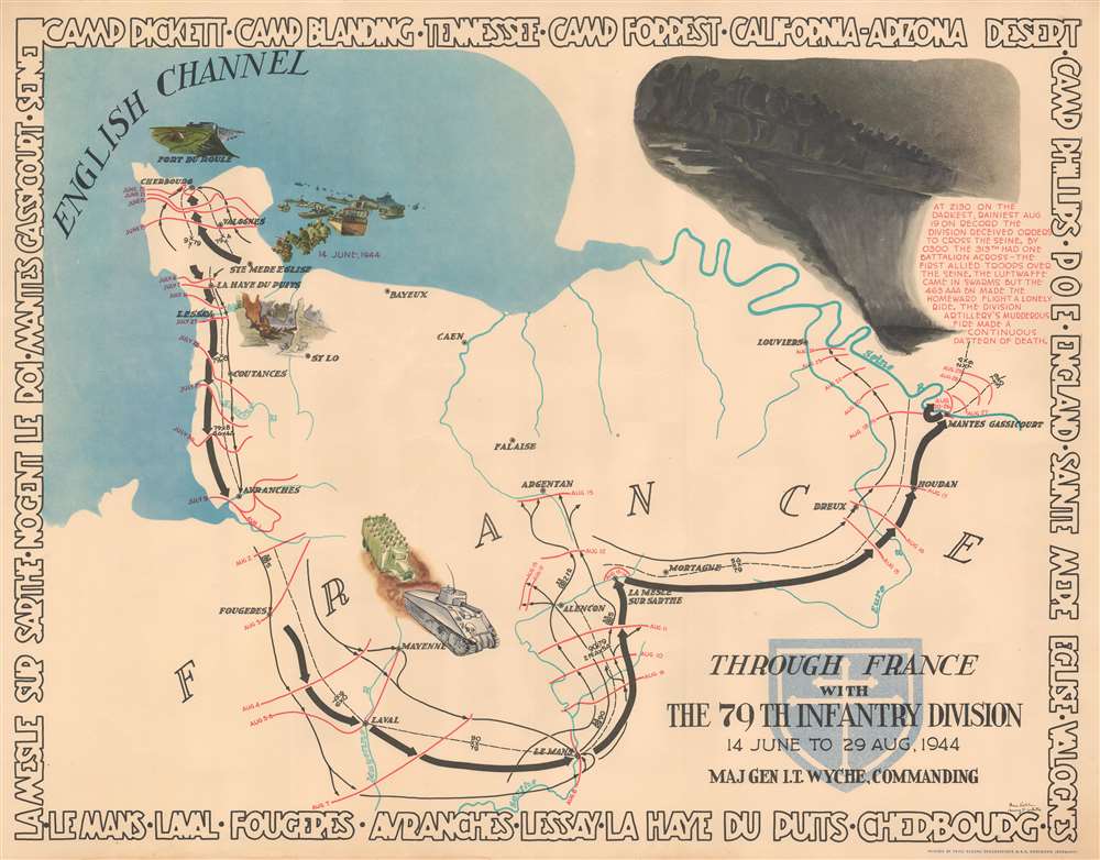
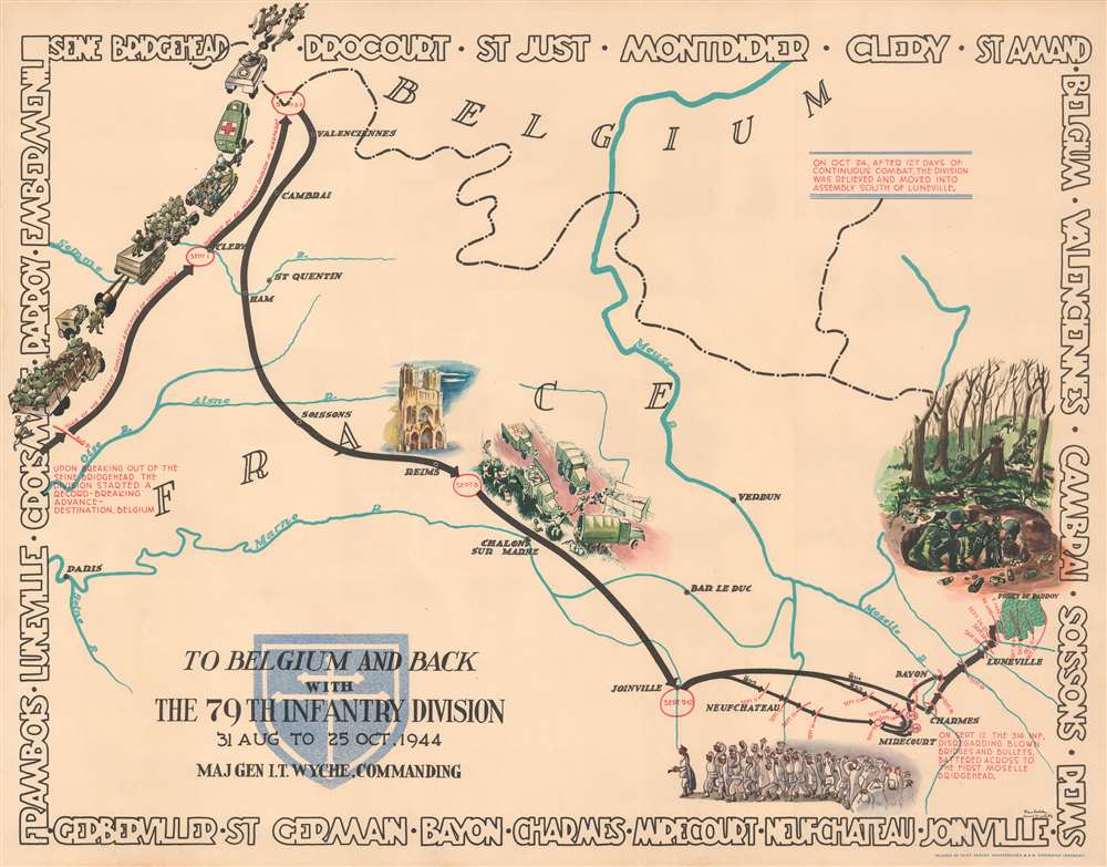
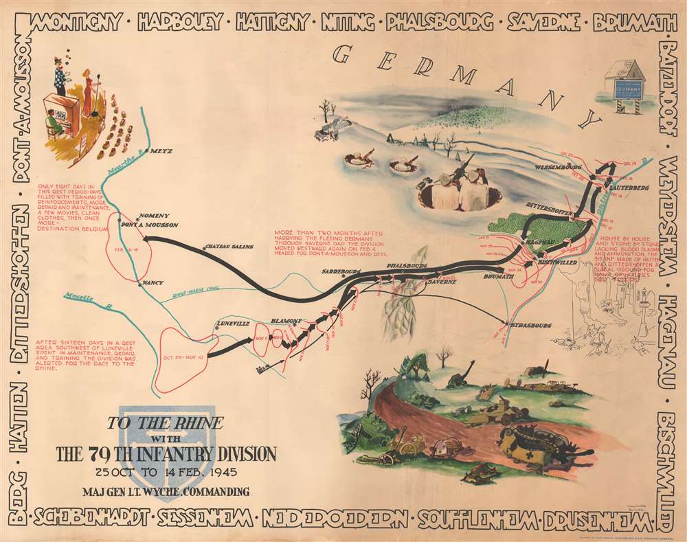
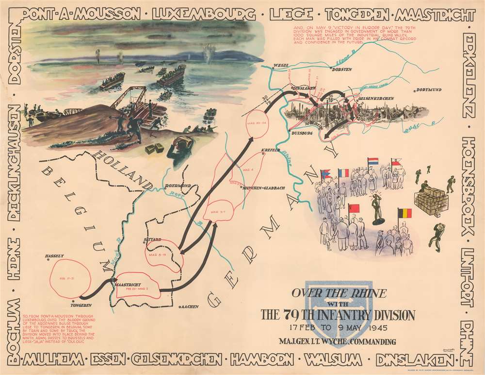
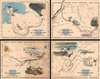
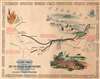
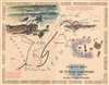
This is a set of four Steve Kaliher and Harry D. White pictorial World War II route maps of the 79th Infantry's advance from Normandy to Germany. Presented on four separate sheets, a detailed summary of the division's progress across northern Europe from Utah Beach (one of the four Normandy beaches assaulted by Allied troops only eight days on what has become known as D-Day) to Mulheim, Germany. Each map traces a sequence of a few months in the combat history of the 79th with red lines labeled with dates marking the advance week by week and sometimes day to day. Text blocks narrate parts of the advance, providing insight into what the division accomplished during their over 300 days of combat. Cities and towns are identified throughout all four maps, as are rivers. Each map is framed by the names of cities and towns that the division passed through on their advance, fought for, and liberated, adding yet another level of memory to each piece.
The third map presents both sides of a soldier's life: attending a U.S.O. show, illustrated along the left border, and the carnage of combat, shown by men in foxholes watching for the enemy, a road littered with destroyed tanks, artillery, aircraft, and other military vehicles, and a sketch of urban combat. An illustration in the upper left of the fourth map depicts the division crossing a river, most likely the Rhine, with a 'view' of an unidentified destroyed German city to its right. The illustration on the lower right celebrates Victory in Europe and commemorates the role the 79th played in the governance of 'more than 1,000 square miles of the industrial Ruhr Valley'.
Featured Actions and Vignettes
Colorful vignettes stand out against the white background and are used to highlight specific actions as well as events in the 79th's drive across Europe. Vignettes on the first map illustrate the division's landing at Utah Beach, which includes depictions of the now famous Higgins Boat, the destruction of Norman cities and villages, and the swift advance once the Allies finally broke out of Normandy, shown by a tank and truck filled with soldiers. The division is illustrated crossing the Seine 'on the darkest, rainiest August 19 on record' in the upper right corner. 'One of the fastest opposed advances of comparable distance by an infantry division in warfare' is highlighted on the upper left of the second map by a column of olive-drab men, vehicles, and tanks pursuing German soldiers. In a nod to the fact that not every day was filled with battle, the Reims Cathedral is beautifully illustrated near the center, while the savage fighting in the Foret de Parroy is highlighted along the right border. The two soldiers in the foreground are manning a mortar and are surrounded by spent casings. A group of German prisoners led by a German officer surrenders along the bottom border.The third map presents both sides of a soldier's life: attending a U.S.O. show, illustrated along the left border, and the carnage of combat, shown by men in foxholes watching for the enemy, a road littered with destroyed tanks, artillery, aircraft, and other military vehicles, and a sketch of urban combat. An illustration in the upper left of the fourth map depicts the division crossing a river, most likely the Rhine, with a 'view' of an unidentified destroyed German city to its right. The illustration on the lower right celebrates Victory in Europe and commemorates the role the 79th played in the governance of 'more than 1,000 square miles of the industrial Ruhr Valley'.
Publication History
These maps were drawn by Steve Kaliher and Harry D. White and printed by Fritz Busche Durckereiges M.B.H. in Dortmund, Germany, in 1945. Maps like these were created after the end of the war by soldiers for their fellow soldiers to take home with them as mementos.Cartographer
Stephen Eugene Kaliher (1910 - October 19, 1969) was an American military officer, artist, and engineer. A native of Ohio, Kaliher was an engineer and surveyor by profession working as a civil engineer at a steel plant in Ohio in 1940. Kaliher enlisted in the U.S. Army in 1942 and served in the 79th Infantry Division, where he attained the rank of Master Sergeant. After the war, Kaliher founded the engineering firm Kohli and Kaliher Associates, Inc, a firm that he worked with until his death. Kaliher was married to Beata Kaliher with whom he had two children. More by this mapmaker...
Condition
Very good. All four sheets exhibit varying degrees of edge wear, including closed margin tears professionally repaired on verso. 17 Feb to 9 May 1945 exhibits some soiling.