1840 Black Map of South Africa and North Africa
AfricaNorthSouth-black-1840$150.00

Title
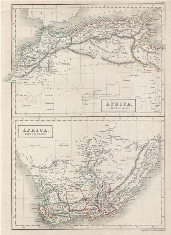
Africa, North Part. Africa, South Part.
1840 (undated) 16 x 11.5 in (40.64 x 29.21 cm)
1840 (undated) 16 x 11.5 in (40.64 x 29.21 cm)
Description
A fine example of Adam and Charles Black's 1840 map of Africa, northern and southern parts. Divided into two parts, the upper map is of the Barbary Coast and covers the western Mediterranean Coast of Africa from Morocco to Tripoli, including modern day Morocco, Algeria, Tunisia and Libya. The lower map covers modern day South Africa and includes the cities and towns of Clanwilliam, Beaufort, Worchester, Cape Town, George, Uitenhage, Stellenbosch, Somerset and Graaff-Reinet. The map of North Africa depicts the Tuat, a vast desert region, marked with numerous oases. The desert area is largely unmapped, simply identified as 'A dry Country abounding in Dates.' The map of South Africa depicts the regions of the various of the Bushmen tribes. This map was engraved by S. Hall for issue in the 1840 edition of Black's General Atlas.
Cartographer
Charles and Adam Black (fl. 1807 - present) were map and book publishers based in Edinburgh. Charles and his uncle, Adam, both of Edinburgh, Scotland, founded their publishing firm in 1807. They published a series of maps and atlases throughout the 19th century. In addition to an array of atlases, the Black firm is known for their editions of the Encyclopedia Britannica (1817 - 1826) and the first publishing of Sir Walter Scott's novels in 1854. In 1889 the A. & C. Black publishing house moved to London where it remains in operation to this day. More by this mapmaker...
Source
Hall, Sydney, Black's General Atlas: A series of Fifty-Four Maps from the Latest and Most Authentic Sources, Engraved on Steel, In the First Style of the Art, (Edinburgh: Adam and Charles Black) 1840.
Condition
Very good. Blank on verso. Original platemark visible.
References
Rumsey 2305.050 (1854 edition). Philips (atlases) 4334.