1820 Yates Map of Albany circa 1770
Albany-yates-1820$90.00
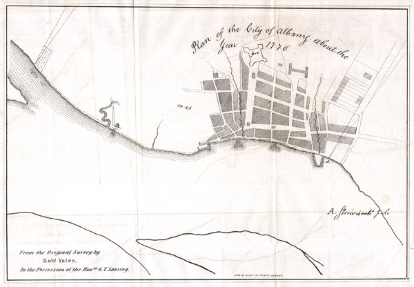

Title
Plan of the City of Albany about the Year 1770.
1820 8.5 x 12 in (21.59 x 30.48 cm)
1820 8.5 x 12 in (21.59 x 30.48 cm)
Description
This is a fascinating 1770 map of the City of Albany, capitol of New York state. Map was drawn from an original survey by Robert Yates from the collection of the Honorable G. Y. Lansing. Drawn and engraved by Richard Pease of Albany. Show the fort and port areas. Undated but given the paper and style we can accurately say it is an early 19th century reprint.
Condition
Very good condition. Original folds as issued. Minor transference. Blank on verso.