1888 Crofutt Map of the Western United States w/ Railroad Tours
AmericanWest-crofutt-1888$450.00
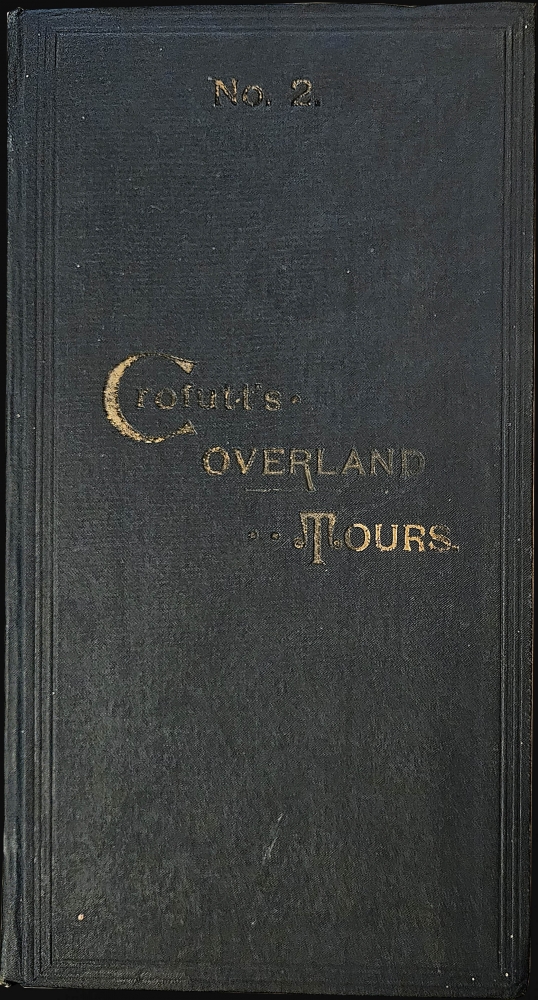


Title
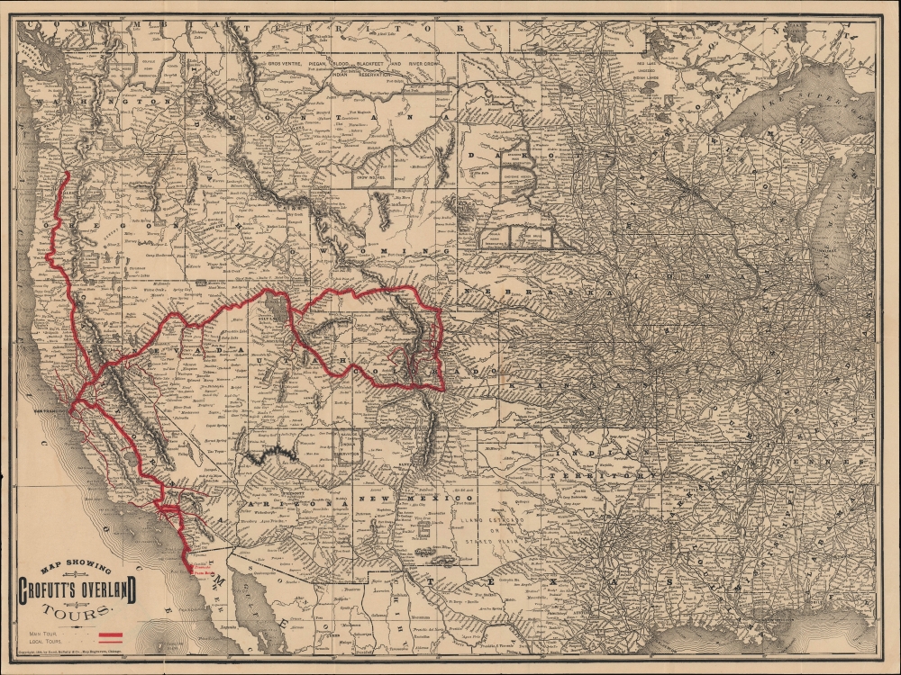
Map showing Crofutt's overland tours.
1888 (dated) 16.75 x 22.25 in (42.545 x 56.515 cm) 1 : 6300000
1888 (dated) 16.75 x 22.25 in (42.545 x 56.515 cm) 1 : 6300000
Description
An uncommon 1888 Rand McNally map illustrating proposed tours of the American West as described in Crofutt's Overland Tours. It was published as the American frontier was 'closing,' in the memorable phrase of historian Frederick Jackson Turner, and was simultaneously being mythologized.
A Closer Look
Coverage ranges from the Pacific Ocean to Lake Michigan, including all the states and territories in-between, with a focus on railroad and stagecoach routes. A red line highlights portions of the Union Pacific, Central Pacific, Denver and Rio Grande, Southern Pacific, and the Atchinson, Topeka and Santa Fe Railways, with local tours indicated by thinner lines. Other rail lines not employed on the tours are marked with black lines, while cities and towns, Indian Reservations, waterways, mountains, and other features are noted throughout.Crofutt and the Myth of the American West
By the 1880s the gold rush had died down, but what remained was a fascination for the richness, landscapes, and sheer wildness of the American West. Traveling theater groups like Buffalo Bill's Wild West Show became sensations in the east and the more adventurous tourists booked transcontinental train voyages to see the wonders of the west. Crofutt's guides and maps were among the principal mechanisms by which such voyages were planned and executed.Publication History and Census
This map was published by Rand McNally to accompany Crofutt's Overland Tours, No. 2, published in 1888. It is similar to a map published in Crofutt's Overland Tours, No. 1 the same year (also sold by us), with the latter highlighting a second set of rail routes to the Pacific Northwest and including more overprinting. Both maps are quite rare, with the present printing only being independently cataloged among the holdings of Texas Tech University.CartographerS
George Andrews Crofutt (1827 - January 27, 1907) was an American publisher, writer, and promoter of the westward expansion. He was born in Danbury, Connecticut. Looking for greater financial opportunities he moved as a young man to New York City and later Philadelphia, where worked as a journalist, publisher, and editor. During the Panic of 1857 he went bankrupt and so, with nothing to lose, joined the Pike's Peak Gold Rush, arriving in Colorado in 1860. Crofutt was unsuccessful as a prospector, but fell in love with the majesty and beauty of the American West. When he attended the May 10, 1869 driving of the Golden Spike at Promontory Summit, Utah, which celebrated the connecting the Central Pacific and the Union Pacific Railroads, he reconnected with his passion for journalism. This began one of the most successful publishing careers in 19th century American. Crofutt was one of the first to recognize and capitalize on the possibilities of transcontinental tourism provided by the completion of the Union Pacific Railroad. He was a great promoter of westward migration, Manifest Destiny, and the settlement of Colorado. He commissioned John Gast's famous 1872 painting, American Progress, and, from 1873, issued limited edition chromolithographs of it. His series of guides, including the Great Transcontinental Railroad Guide, Crofutt's Overland Tourist, Crofutt's Overland Tours, Crofutt's Grip-Sack Guide and more, were among the first travel guidebooks to focus on the American West. These revolutionary guides included engravings (and later photographs) of natural wonders and indigenous peoples, as well as train and stage schedules, maps, fare information, and regional descriptions. Crofutt publications proved so popular that by 1878 he claimed to have sold more than 300,000 copies of his Overland Tourist. Fifer described Crofutt as 'One of the most prolific and widely-read authors on the American West in the last half of the 19th century.' Crofutt died in New York City at age 79. More by this mapmaker...
Rand, McNally and Co. (fl. 1856 - present) is an American publisher of maps, atlases and globes. The company was founded in 1856 when William H. Rand, a native of Quincy, Massachusetts, opened a print shop in Chicago. Rand hired the recent Irish immigrant Andrew McNally to assist in the shop giving him a wage of 9 USD per week. The duo landed several important contracts, including the Tribune's (later renamed the Chicago Tribune) printing operation. In 1872, Rand McNally produced its first map, a railroad guide, using a new cost effective printing technique known as wax process engraving. As Chicago developed as a railway hub, the Rand firm, now incorporated as Rand McNally, began producing a wide array of railroad maps and guides. Over time, the firm expanded into atlases, globes, educational material, and general literature. By embracing the wax engraving process, Rand McNally was able to dominate the map and atlas market, pushing more traditional American lithographic publishers like Colton, Johnson, and Mitchell out of business. Eventually Rand McNally opened an annex office in New York City headed by Caleb S. Hammond, whose name is today synonymous with maps and atlases, and who later started his own map company, C. S. Hammond & Co. Both firms remain in business. Learn More...
Source
Crofutt, G. A., Corfutt's Overland Tours, (Chicago and New York: Rand McNally) 1888.
Condition
Good. Wear along original fold lines. Closed tear extending 1.25 inches into printed area from left border professionally repaired on verso. Small area of infill at a fold intersection. Accompanied by original guidebook.
References
OCLC 1097556563.