1845 Ewing Map of Austria
Austria-ewing-1845$100.00

Title
Austria.
1845 (undated) 8 x 10 in (20.32 x 25.4 cm) 1 : 5700000
1845 (undated) 8 x 10 in (20.32 x 25.4 cm) 1 : 5700000
Description
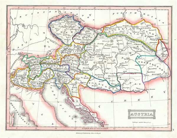
This is a lovely 1845 Thomas Ewing map of the Austria. The map covers the territories claimed by the once vast Austrian Empire, including in whole or part the modern day nations of Austria, Hungary, Germany, Italy, Albania, Croatia, Romania, and the Czech Republic. It also includes parts of Turkey, Switzerland, Germany, Russia, Prussia and Poland. Various important towns, cities, rivers, mountains and several other topographical details are noted with relief shown by hachure.
The Austrian Empire, founded in 1804 by the last Holy Roman Emperor, Francis II, lasted only till 1866. It was transformed into the Austro-Hungarian Empire after Austria was defeated in the Austro-Prussian War of 1866.
This map was published in 1845 by Oliver and Boyd as part of Ewing's New General Atlas.
Source
Oliver and Boyd, Ewing's New General Atlas: containing Distinct Maps of all the Principal States and Kingdoms throughout the World, (Edinburgh) 1845.
Condition
Very good. Minor foxing at places. Blank on verso.