
This item below is out of stock, but another example (left) is available. To view the available item, click "Details."
Details
1944 Albert Richard Pictorial Broadside Map Promoting U.S. Military Aviation
$850.00
1944 Albert Richard Pictorial Broadside Map Promoting U.S. Military Aviation
AviationCavalcade-cheeseman-1944$500.00

Title
Aviation Cavalcade. Wings Over the World…Yesterday, Today and Tomorrow.
1944 (dated) 17 x 22 in (43.18 x 55.88 cm)
1944 (dated) 17 x 22 in (43.18 x 55.88 cm)
Description
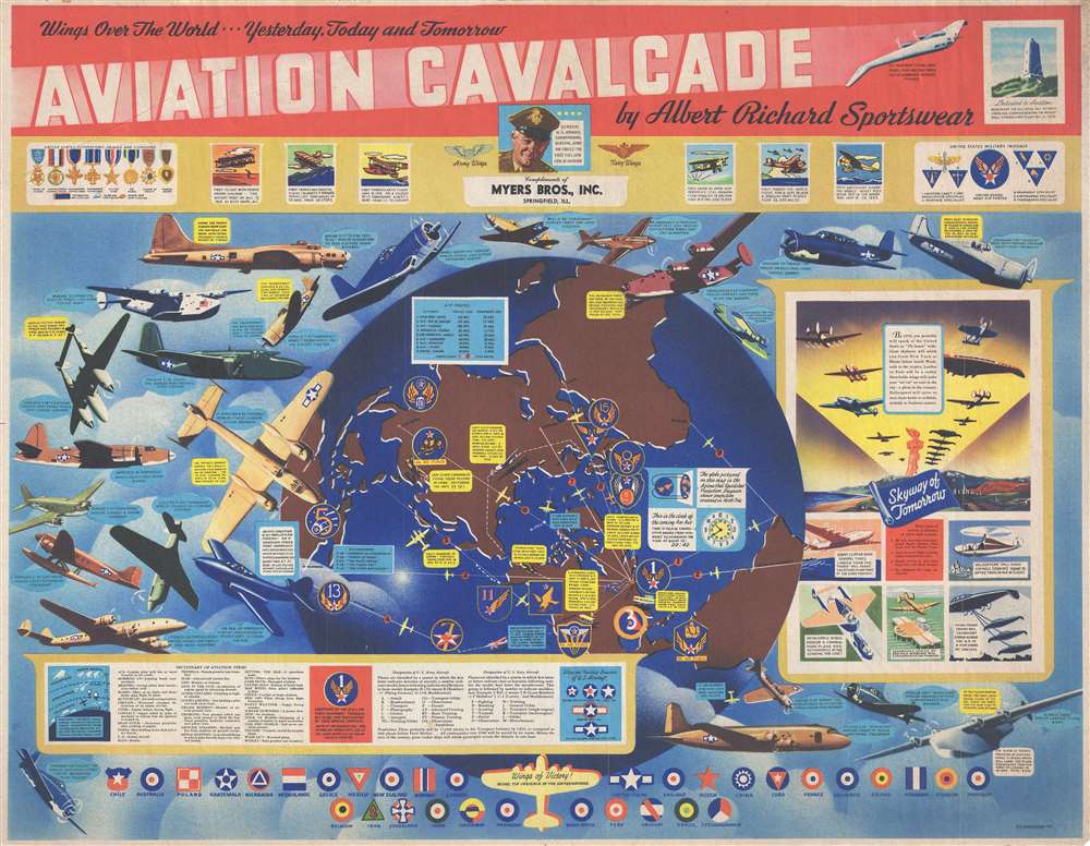
This is a 1944 World War II era F. E. Cheeseman and Albert Richard pictorial propaganda map celebrating U.S. military aviation.
A Closer Look
The striking image radiates from a central image of a globe centered on the North Pole. The globe is overlayed with 9 air routes, illustrating distances between New York and various global cities. Information concerning historic flights is included: the first Transatlantic flight, Amelia Earhart's first solo flight across the Pacific, and the first aerial circumnavigation. Other wartime information is overlaid, such as the location of the 15 U.S. Air Force Commands, General Chennault's Flying Tigers in Southeast Asia, and the now famous Doolittle Raid. A table of air routes (specifically those depicted on the world map), with current and projected flight times, is included at the upper left.Planes, Planes, and More Planes!
The map's most arresting elements are the two dozen aircraft dramatically illustrated. Each aircraft is labeled and accompanied by a laudatory caption. Among these are the B-17 'Flying Fortress,' the Chance-Vought F4U 'Corsair,' the Republic P-47 'Thunderbolt,' the Lockheed P-38 'Lightning,' and the North American P-51 'Mustang.' Each of these aircraft played a critical role in the Allied WWII war effort and demonstrated key technological improvements.This History of Aviation and Projections for the Future - Flying Cars?!
Several text boxes create a sort of border around the aircraft and include information about the history of powered flight, U.S. military decorations, medals, citations, insignia, a 'dictionary of aviation terms', and an explanation of U.S. Army and U.S. Navy aircraft designations. Two boxes along the right contain predictions concerning the future of aviation, stating that 'giant skyliners will whisk you from New York to Miami before lunch' and that 'detachable wings will make your 'air car' an auto in the city - a plane in the country'. A sea change is predicted: the 'skyway of tomorrow' with flying freight trains. The insignia of the United Nations is illustrated along the bottom border.Publication History and Census
This map was drawn by F. E. Cheeseman and published by Albert Richard Sportswear in 1944. We believe that each location that sold Albert Richard products was given these broadsides with the business's name printed on it, as Myers Bros., Inc. of Springfield, Illinois, is printed on this example. Today, this map is extremely rare.CartographerS
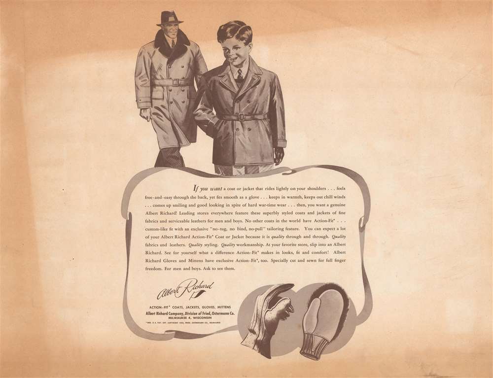
Albert Richard Company (c. late 1920s - c. 1955) began as a division of the Fried-Ostermann Company of Milwaukee, Wisconsin. Fried-Ostermann was a glove manufacturer, and in the late 1920s, decided to diversify their production and opened a division to produce outerwear, which they called Albert Richard. Albert Richard produced leather jackets, mackinaws, overcoats, and sportswear and would soon become more profitable than the glove-making part of the company. Before World War II, Albert Richard advertising focused on health and sports, and received endorsements from college football players. From about 1938 to 1950, Albert Richard partnered with F. E. Cheeseman to published a series of poster size college football maps, which bore advertisements for the company’s jackets on the verso. After the outbreak of World War II, Albert Richard began manufacturing flight jackets for the military under the name of their parent company Fried-Ostermann. Leather jackets, overcoats, and similar products were heavily advertised by Albert Richard during the war. They also gave their jackets model names like ‘Spitfire’ and ‘Meteor’. During the war Albert Richard also gave away wall-sized posters depicting various American military aircraft. Fried-Ostermann sold Albert Richard to the Drybak Corporation of Binghampton, New York in 1952. Daybook began manufacturing Albert Richard clothing in 1953 at a factory in New Jersey, with plans to move production to New York by 1954. However, in 1955, Drybak bought the Martin Mfg. Co. of Martin, Tenessee, closed their operations in Binghampton and moved to the plant in Tennessee, where labor prices were lower. More by this mapmaker...
F. E. Cheeseman (fl. c. 1938 - 1946) is known for the colorful set of four college football maps he produced for the Albert Richard Company between 1938 and 1946. He signed some of his maps as F. E. Cheeseman and others as E. E. Cheeseman, although it is not known why. During World War II, Cheeseman's work for Albert Richard changed and became much more patriotic. He also created military-themed work for Albert Richard during the war. Learn More...
Condition
Very good. Some toning. Printed advertisement on verso.