1930 Chinese City Map or Plan of Beijing (Peking), China
Beijing-anon-1930$1,150.00

Title
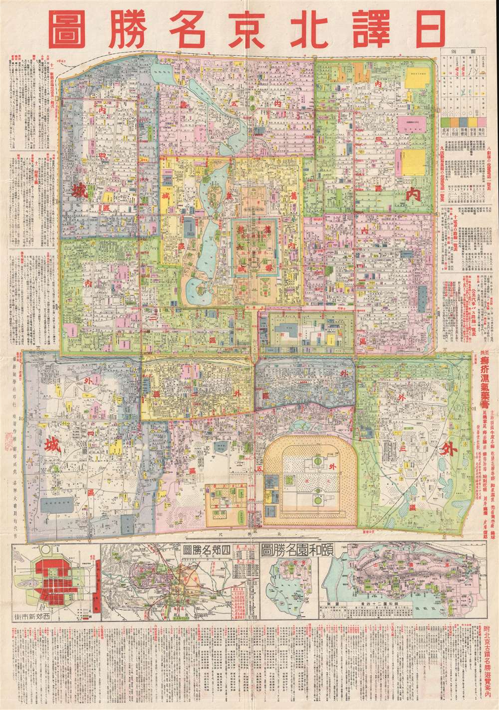
Beijing. / 圖勝名京北譯日.
1930 (undated) 30.5 x 21.5 in (77.47 x 54.61 cm) 1 : 16500
1930 (undated) 30.5 x 21.5 in (77.47 x 54.61 cm) 1 : 16500
Description
This is a c. 1930 Chinese city map or plan of Beijing (Peking), China. The map depicts the Outer city, the Inner city, the Imperial city, and the Forbidden City in minute detail, Myriad streets are labeled, as are various buildings, parks, temples, and altars. The Legation Quarter just outside the Imperial City is shaded a light green with white at its center and several of the legations are labeled. Text is present to the left and right of the plan, along with a key explaining the various notations used. Three smaller inset maps are situated along the bottom of the central map of Beijing and depict, from left to right, West Qin, the environs of Beijing, and the Tusheng Garden.
Condition
Very good. Wear and toning along original fold lines. Blank on verso.