1915 Downs Bird's-Eye View of Cape Cod, Massachusetts
BirdsEyeCapeCod-downs-1915$850.00

Title
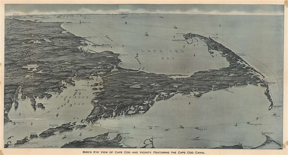
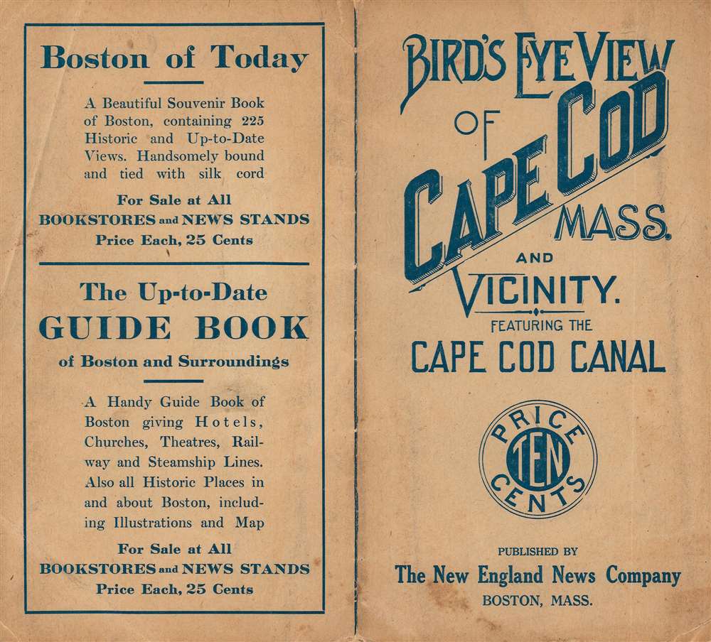
Bird's Eye View of Cape Cod and Vicinity, Featuring the Cape Cod Canal.
1915 (dated) 12.5 x 22.75 in (31.75 x 57.785 cm)
1915 (dated) 12.5 x 22.75 in (31.75 x 57.785 cm)
Description
This is a dramatic 1915 Albert E. Downs bird's-eye view map of Cape Cod, Massachusetts, including the recently completed Cape Cod Canal. This ephemeral style of map became popular in the early 20th century when they were printed and sold by various newsstands operating in train and ferry stations throughout New England, but primarily in Boston.
A Closer Look
Cape Cod dominates the foreground, with the northern extremes of Martha's Vineyard and Nantucket appearing along the bottom border. Towns and villages throughout are illustrated, some with discernable buildings. Among these are Barnstable, Provincetown (with the Pilgrim Monument clearly illustrated), Woods Hole, and Plymouth. Boston occupies the upper left horizon. Labeled lighthouses appear all along the coastline. Dashed lines mark shipping routes.The Cape Cod Canal
The Cape Cod Canal stretches seven miles across the neck connecting Cape Cod with the mainland. Construction began on June 22, 1909, and the canal opened on July 29, 1914, on a limited basis. It was completed in 1916. The canal, part of the Atlantic Intracoastal Waterway, negates the need to travel around the Cape, shortening the journey by 135 miles.Publication History and Census
This map was created by Albert E. Downs and published by the New England News Company in 1915. We note three examples cataloged in OCLC which are part of the collections at Harvard University, the State Library of Massachusetts, and the University of Michigan. We note only two other instances when this map has appeared on the private market since 2005.Cartographer
Albert Elroy Downs (1856 - 1923) was an American artist, lithographer, and publisher. Born in Lowell, Massachusetts, Downs spent his entire life in Massachusetts. He graduated from the Bigelow School in Boston and likely trained with the American landscape painter George Loring Brown (1814 - 1889), from 1872 until 1877, although the exact dates are unclear. Downs was active from at least 1880, when his initials A D appeared on a view of Fort Atkinson, Wisconsin, until 1914, when he collaborated with T. M. Fowler on a view of Haverhill, Massachusetts. Over the course of his career he created views of Essex, Connecticut; Richmond, Indiana; Athens, Georgia; and Scranton, Pennsylvania, along with numerous others. More by this mapmaker...
Condition
Good. Backed on archival tissue for stability. Closed tear extending four (4) inches into the printed area from left margin professionally repaired on verso. Minor reinstatement near Buzzards Bay. Light staining to margins.
References
OCLC 34049371.