This item has been sold, but you can get on the Waitlist to be notified if another example becomes available, or purchase a digital scan.
1830 Map of Boston, Massachusetts
Boston-unknown-1830$62.50

Title
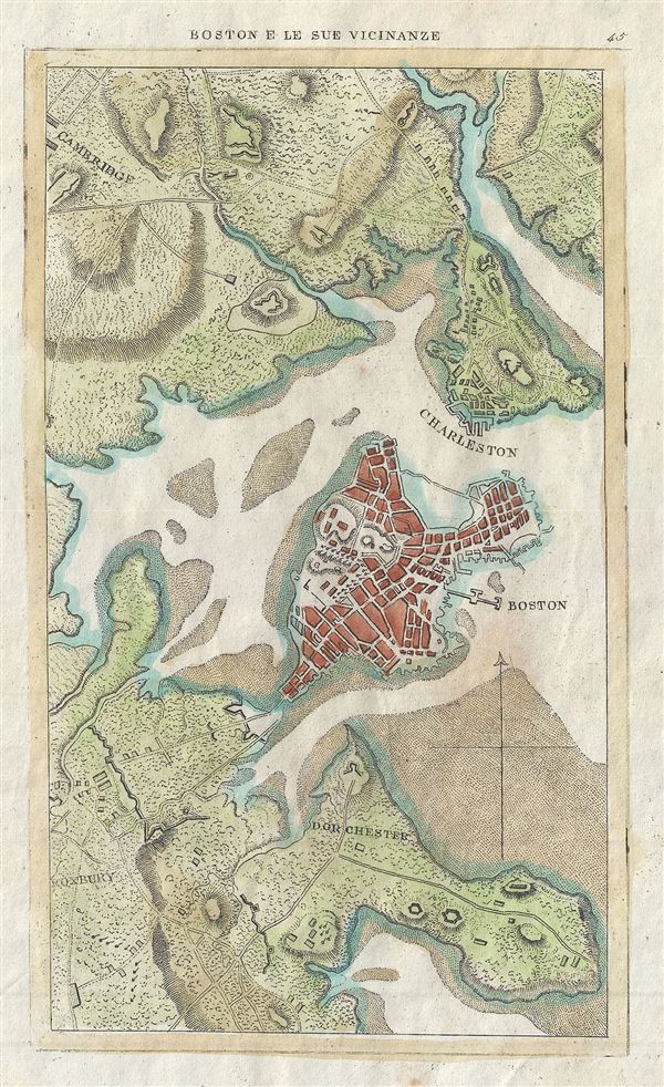
Boston e le Sue Vicinanze.
1830 (undated) 8 x 5 in (20.32 x 12.7 cm)
1830 (undated) 8 x 5 in (20.32 x 12.7 cm)
Description
This is a beautiful c.1830 map or plan of Boston, Massachusetts. It covers the city of Boston from Cambridge to Roxbury. Beautifully rendered in stupendous detail, it notes tows, forts, roads, buildings and topography. Identifies Roxbury, Dorchester, Charleston, and Cambridge.
Condition
Very good. Blank on verso.