1955 U.S. Air Force Aeronautical Chart or Map of the Cachimbo Range, Brazil
CachimboRange-usaf-1955$100.00

Title
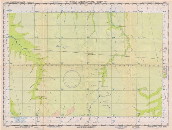
Cachimbo Range Brazil.
1955 (dated) 22 x 29 in (55.88 x 73.66 cm) 1 : 1000000
1955 (dated) 22 x 29 in (55.88 x 73.66 cm) 1 : 1000000
Description
This is a scarce 1955 U.S. Air Force aeronautical chart or map of the Cachimbo Range, Brazil. It covers parts of the Brazilian states of Para and Mato Grosso from Ilha Guandu south to Pouso Alegre and east as far as Aldeias dos Tapirapes. The map is highly detailed and notes several rivers, towns, lakes, villages and other hydrographical and topographical features essential for the air pilot. Verso of this chart features legends and a World aeronautical chart index. This chart was published by the USAF Aeronautical Chart and Information Service and was issued as chart no. 1069. First issued in 1943, this is the second edition revised to Feb 1955.
Condition
Very good. Minor wear and toning along original fold lines. Minor spotting.