1952 U.S Air Force Aeronautical Chart or Map of the Cariris Novos Range, Brazil
CaririsNovosRange-usaf-1952$100.00

Title
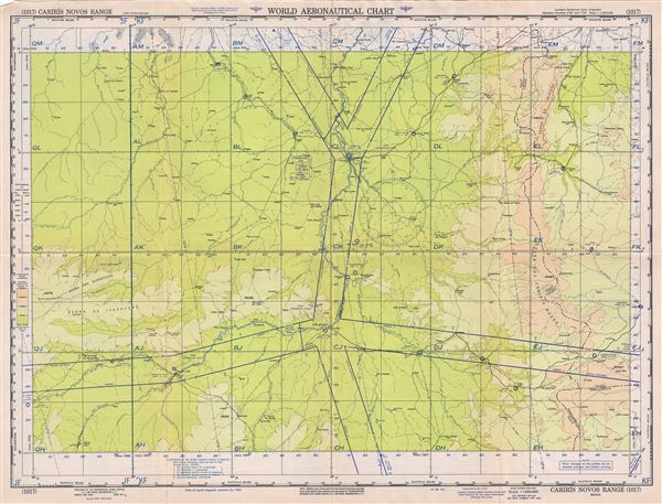
Carisis Novos Range Brazil.
1952 (dated) 22 x 29 in (55.88 x 73.66 cm) 1 : 1000000
1952 (dated) 22 x 29 in (55.88 x 73.66 cm) 1 : 1000000
Description
This is a fine 1952 U.S. Air Force aeronautical chart or map of the Cariris Novos mountain range along the boundaries of the States of Ceara and Piaui, Brazil. It covers the range and its vicinity from Piripiri south to Simplicio Mendes and from Saboeiro westward as far as Anaja. The cities of Teresina, Picos, Floriano, etc. are noted. The map is highly detailed and notes several rivers, towns, lakes, villages and other hydrographical and topographical features essential for the air pilot. Verso of this chart features legends and a world aeronautical chart index. This chart was published by the USAF Aeronautical Chart and Information Service, and was issued as chart no. 1017. First issued in 1949, this is the second edition revised to April 1952.
Condition
Very good. Minor wear and toning along original fold lines. Minor spotting.