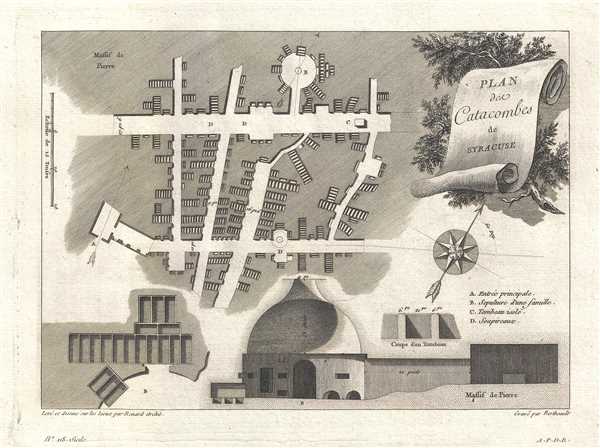
This is a 1786 Pierre-Gabriel Berthault map of the catacombs of Syracuse, Italy. The map depicts the network of catacombs under the city. The author of Voyage Pittoresque ou Description des Royaumes de Naples et de Sicile described the catacombs as 'an underground city, with its large and small roads, its intersections, and its holes for creating tombs.' Certain aspects of the catacombs are also depicted, including a drawing of the entrance to the catacombs and two different sketches of how the tombs were placed. The title appears on a scroll backed by pine branches.
The map was drawn by Renard, an architect, and engraved by Berthault. It was published in Voyage Pittoresque ou Description des Royaumes de Naples et de Sicile. Quatrième Volume, contenant la Description de la Sicile. Seconde Partie. by Jean Claude Richard de Saint Non in Paris in 1786.
Source
Saint Non, Jean Claude Richard de,Voyage Pittoresque ou Description des Royaumes de Naples et de Sicile. Quatrième Volume, contenant la Description de la Sicile. Seconde Partie., (Paris: Imprimerie de Clousier) 1786
Very good. Blank on verso.
OCLC 692977130.