1840 Basset Comparative Chart of the Chateaux of France
ChateauxComparatif-basset-1840$750.00

Title
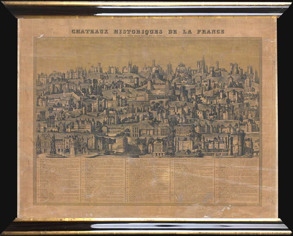
Chateaux Historiques de la France.
1840 (undated) 18.5 x 23.5 in (46.99 x 59.69 cm)
1840 (undated) 18.5 x 23.5 in (46.99 x 59.69 cm)
Description
This is a c. 1840 Maison Basset comparative chart of the Chateaux of France. The chart depicts 71 different French chateaux in profile, from the Château d'Isières to the Tour et Porte de Nesle, which was demolished in 1663. Each of the chateau presented is numerically identified. A table along the bottom border, organized in ascending numerical order, includes the name of each chateau, along with the department in which it is located, it's location relative to the closest city or town, and a short description. The detail renders each chateau visually recognizable. Some of the chateaux represented here have gained international renown, including Mont St. Michel, the Chateau de Tuileries (which today we know as the Louvre, since the two were connected by Louis XIII and Louis XIV), the Chateau de Vincennes, the Chateau de Fontainebleau, the Chateau de Versailles, and the Chateau de Chenonceau (in the Loire Valley). The Vieux Louvre, demolished in 1528, is also depicted.
Publication History
This chart was published by Maison Basset in Paris c. 1840. It is one of a series of maps issued by Basset offering comparative views. Others in the series include comparative buildings of the world, heights of mountains, and the wonders of nature. In particular, the Chateaux Historiques de la France view is extremely rare and we have been able to isolate no other examples.Condition
Good. Mounted as a wall map. Varnished over. Varnish exhibits moderate degradation. Some whitening. Slightly shinier than map appears in image. Could be removed by professional restorer.