This item has been sold, but you can get on the Waitlist to be notified if another example becomes available, or purchase a digital scan.
1890 Cleveland Directory Company Map or Plan of Cleveland, Ohio
Cleveland-clevelenddirectory-1890$125.00

Title
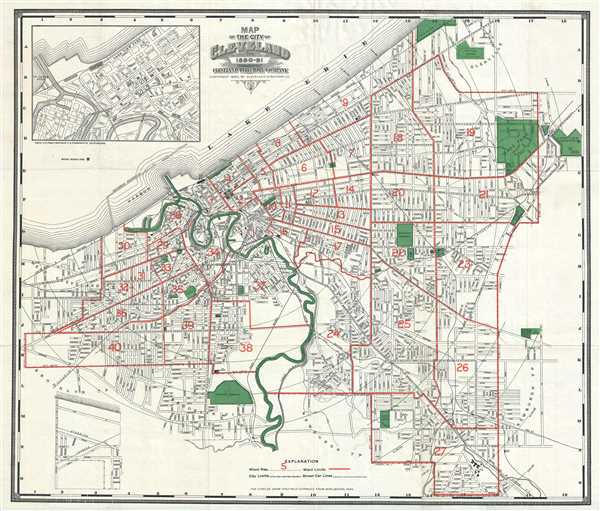
Map of the City of Cleveland for 1890-91.
1890 (dated) 25 x 28 in (63.5 x 71.12 cm) 1 : 19000
1890 (dated) 25 x 28 in (63.5 x 71.12 cm) 1 : 19000
Description
This is a beautiful 1890 map of the city of Cleveland, Ohio issued by the Cleveland Directory Company. The map extends southward from Lake Erie and covers the entire city of Cleveland at the time, centered on the Cuyahoga River. An inset in the top left quadrant focuses on the downtown area.
Due to its proximity to Lake Erie, Cleveland is locally known as ‘The North Coast’. Other nicknames Clevelanders have given to the city include ‘C-Town’ and ‘The Forest City’. The map is highly detailed and notes parks, piers, cemeteries, railways and other topographical details. Wards are numbered and outlined in red. Concentric circles show half-mile distances from Monumental Park.
This map was issued as a folding map in 1890 by the Cleveland Directory Company.
Condition
Very good. Minor verso reinforcements along fold intersections.