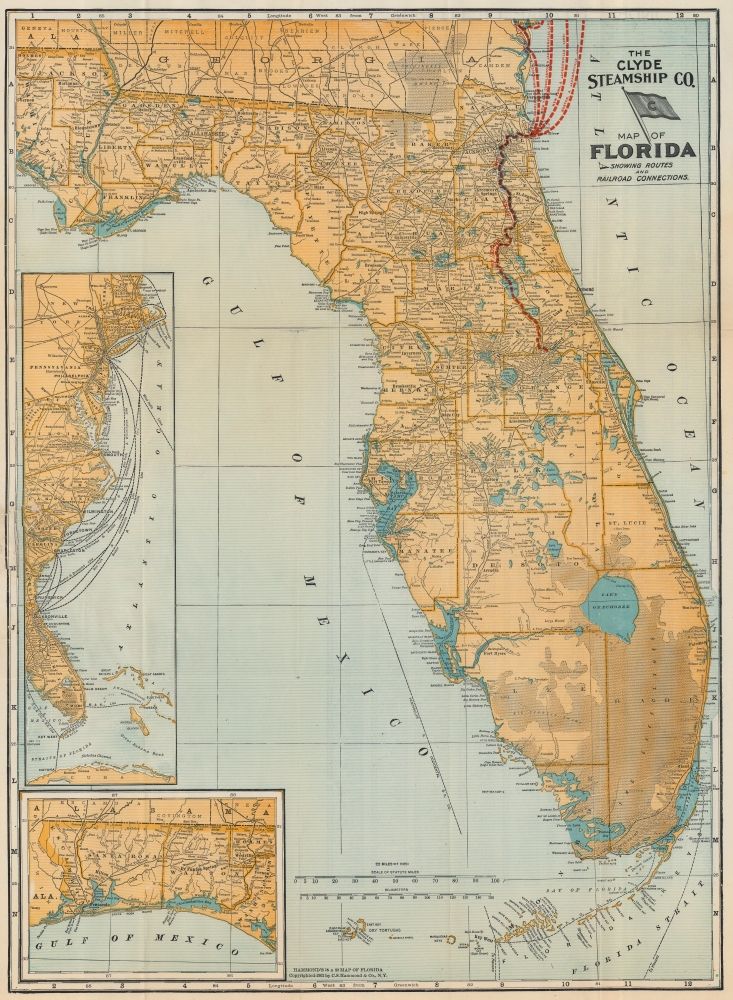
This is a 1903 Clyde Steamship Company map of Florida. Overprinted red dashed lines mark the Clyde Steamship Company's routes out of Jacksonville north to Charleston, New York, and Boston, as well as the St. John's River Line from the coast inland south along the river to Sanford. An inset map along the left border traces the company's many routes from their terminal in Florida to destinations along the coast. A second inset map, in the lower left, details the Florida panhandle from the Alabama border to Washington County.
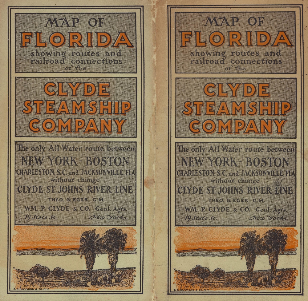
The Clyde Steamship Company
William P. Clyde (October 11, 1839 - November 18, 1923) founded the Clyde Steamship Company in 1874. By 1882, it operated routes between New York and Florida, Key West, Havana, and New Orleans. By 1899, its network had expanded to include routes south from Boston, Providence, New York, and Philadelphia, as well as a St. John River line to Jacksonville, Florida. By 1902, Clyde Steamship Company operated tri-weekly departures from Jacksonville to New York. Charles W. Morse's Consolidated Steamship Lines purchased the Clyde Steamship Company in 1907, but that company collapsed in 1908. The Atlantic, Gulf, and West Indies Steamship Lines took over the Clyde Line in 1911, but the Clyde Line name and flag continued to be used until 1932, when the Clyde Line was merged with the Mallory Line to form the Clyde-Mallory Line.Publication History and Census
This map was created by C.S. Hammond and Company and published by the Clyde Steamship Company in 1903. An example is part of the Touchton Map Library at the Tampa Bay History Center. Five examples are cataloged in OCLC and are part of the institutional collections at Yale University, the University of Georgia, the Newberry Library, the University of Illinois Urbana-Champaign, and the Kansas State Historical Society.
Cartographer
Caleb Stillson Hammond (1862 - 1929) was the founder of C. S. Hammond & Company, a map making and printing firm based in Brooklyn, New York. Hammond started his career in mapmaking as the head of Rand McNally's offices in New York City, where he began working in 1894. Hammond split with Rand McNally, forming his own printing concern in Brooklyn, New York, in 1900. The firm was subsequently incorporated in 1901 and relocated to Manhattan, and then to Maplewood, New Jersey, near Hammond's family home. Hammond rose to become one of the largest cartographic publishers in the United States, second only to Rand McNally in volume. On his retirement, C. S. Hammond passed the firm to his son, who subsequently passed it to his own son, C. D. Hammond, who sold the company to Langenscheidt Publishers in 1999. The firm has since been folded into Universal Map, an affiliate of Kappa Publishing Group. This archives of the Hammond World Atlas Corporation, an invaluable resource, where donated to the Library of Congress in 2002. More by this mapmaker...
Fair. Verso repairs to separations at fold intersections. Area of reinstatement along left border between 'G' and 'H' within the inset. Close left margin. Location index on verso.
Tampa Bay History Center, Touchton Map Library, M1164. OCLC 38987295.