
Hammond, Caleb Stillson

Caleb Stillson Hammond (1862 - 1929) was the founder of C. S. Hammond & Company, a map making and printing firm based in Brooklyn, New York. Hammond started his career in mapmaking as the head of Rand McNally's offices in New York City, where he began working in 1894. Hammond split with Rand McNally, forming his own printing concern in Brooklyn, New York, in 1900. The firm was subsequently incorporated in 1901 and relocated to Manhattan, and then to Maplewood, New Jersey, near Hammond's family home. Hammond rose to become one of the largest cartographic publishers in the United States, second only to Rand McNally in volume. On his retirement, C. S. Hammond passed the firm to his son, who subsequently passed it to his own son, C. D. Hammond, who sold the company to Langenscheidt Publishers in 1999. The firm has since been folded into Universal Map, an affiliate of Kappa Publishing Group. This archives of the Hammond World Atlas Corporation, an invaluable resource, where donated to the Library of Congress in 2002.
Take a steamship to Florida from New York!
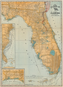
The Clyde Steamship Co. Map of Florida Showing Routes and Railroad Connections.
$325.00
Acquire
- Digital Map Information
- Suitable for large format printing
- Full resolution TIFF file
- ICC color profile embedded
- Delivered instantly via download link
This is a 1903 Clyde Steamship Company map of Florida. Overprinted red dashed lines mark the Clyde Steamship Company's routes out of Jacksonville north to Charleston, New York, and Boston, as well as the St. John's River Line from the coast inland south along the river to Sanford. An inset map along the left border traces the company's many routes from their terminal in Florida to destinations along the coast. A second inset map, in the lower left, details the Florida panhandle from the Alabama border to Washington County. (more details)
New York's Steamboat Era: The floating palaces.
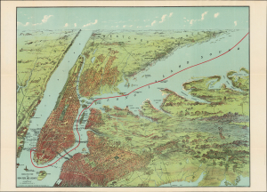
Birds Eye View of New York and Vicinity.
$650.00
Acquire
- Digital Map Information
- Suitable for large format printing
- Full resolution TIFF file
- ICC color profile embedded
- Delivered instantly via download link
This is a scarce 1912 chromolithograph C. S. Hammond map and view of New York City and vicinity, issued as a souvenir for steamship travelers to and from New York City. The map captures New York at the height the 'floating palace' regional steamboat era. (more details)
Important Precursor to the Great War.
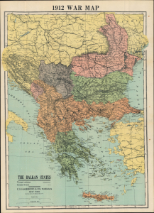
1912 War Map / The Balkan States.
$400.00
Acquire
- Digital Map Information
- Suitable for large format printing
- File Size: 26.08 MB
- File Type: ZIP / TIFF
- ICC color profile embedded
- Delivered instantly via download link
This is a 1912 C. S. Hammond map of the Balkans and southeastern Europe illustrating the theater of war of the First Balkan War (October 1912 - May 1913), an oft-forgotten but important precursor to World War I (1914 - 1918). (more details)
Illustrates the Long Island Railroad and Long Island's highway network.
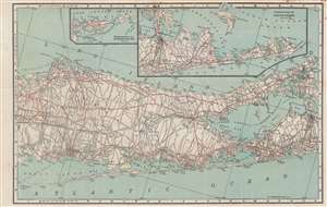
Hammond's New Road Map Long Island.
$600.00
Acquire
- Digital Map Information
- Suitable for large format printing
- Full resolution TIFF file
- ICC color profile embedded
- Delivered instantly via download link
This is a 1914 C.S. Hammond double-sided road map of Long Island with eastern Suffolk County on the recto and New York City on the verso. (more details)
Parkways, turnpikes, motor roads.
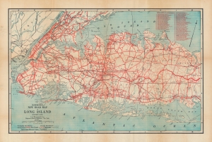
Hammond's New Road Map Long Island.
$600.00
Acquire
- Digital Map Information
- Suitable for large format printing
- Full resolution TIFF file
- ICC color profile embedded
- Delivered instantly via download link
A highly detailed 1918 C.S. Hammond double-sided road map of Long Island and New York City. It demonstrates the transformation of Long Island from rural farmland and forest to a suburban continuation of the New York metro area, a transformation facilitated by the rapid development of highways. (more details)
Go visit the New York World's Fair!
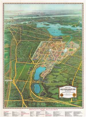
Map of the New York World's Fair and Approaches.
$350.00
Acquire
- Digital Map Information
- Suitable for large format printing
- Full resolution TIFF file
- ICC color profile embedded
- Delivered instantly via download link
This is a 1939 Edward V. Spofford bird's-eye view map of the 1939 New York World's Fair. Overlooking the fair from a fictional highpoint to the east, many of the fair's buildings are illustrated. The famous Trylon and Perisphere are immediately recognizable. 'Streets' throughout the fairground are identified, along with Constitution Mall and several 'courts'. Subway stations, bus parking areas, and the Long Island Rail Road station are also labeled. Outside the World's Fair, main thoroughfares and subway lines recognizable in Queens, the Bronx, and Manhattan as far south as 34th Street and the Empire State Building. The Queens Midtown Tunnel is labeled as being under construction. Central Park, Rockefeller Center, and the Lincoln Tunnel are also identified. (more details)
Features a visually arresting border highlighting American air, land, and sea power to be used in the coming war.
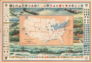
Defense Map of the United States Prepared by C.S. Hammond and Company, N.Y. Showing the Mobilization of our Military and Economic Resources.
$450.00
Acquire
- Digital Map Information
- Suitable for large format printing
- File Size: 68.33 MB
- File Type: ZIP / TIFF
- ICC color profile embedded
- Delivered instantly via download link
This is a c. 1941 C. S. Hammond and Company pictorial map of the United States highlighting the military and economic resources available on the brink of World War II. Blue-colored cogs highlight industrial areas around the country to illustrate the manufacturing might that could be brought to bear. Other defense industries are marked on the map by icons, including shipyards, factories for making planes, airplane engines, munitions, tanks, guns, steel, and aluminum. Army and navy bases are identified as well, as are army and navy airfields. (more details)
Reimagining Race at the Field Museum.
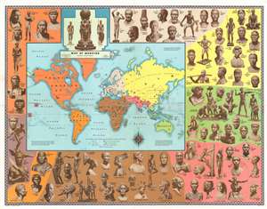
Map of Mankind.
$1,000.00
Acquire
- Digital Map Information
- Suitable for large format printing
- Full resolution TIFF file
- ICC color profile embedded
- Delivered instantly via download link
This is a 1946 Malvina Hoffman and C. S. Hammond map of the world illustrating the 'races of mankind'. The map of the world is surrounded by seventy-seven of Hoffman's bronzes from her Races of Mankind series, created for Chicago's Field Museum. Colors highlight different geographical regions and group the sculptures, associating race with geography. (more details)
Entices the adventurous with the suggestion of buried treasure and lost fortunes, and of course 'X' marks the spot!
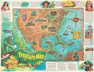
Hammond's Fabulous Treasure Map.
$200.00
Acquire
- Digital Map Information
- Suitable for large format printing
- File Size: 31.27 MB
- File Type: ZIP / TIFF
- ICC color profile embedded
- Delivered instantly via download link
This is a 1959 Chuck Mazoujian pictorial treasure map of Central and North America. The map depicts the region from the Pacific Ocean to the Atlantic Ocean and from southern Canada to northern South America. As this is a treasure map, numerous different tales of lost treasure are referenced here, each of which provides a location and the amount of money supposedly hidden there. Each location is marked by a shovel and pick axe set in the form of and 'X', with the exception of eight, which are numerically identified. These eight locations are the 'interesting treasure locations of North America' and a more detailed story is recounted for them in an index situated along the bottom border. Among the treasures referenced is loot buried by notorious outlaws, such as Jesse James and John Dillinger, lost mines, and numerous shipwrecks. Pirates are profiled around the border, including Blackbeard, Mary Anne Blythe (known as the 'Strip Tease Pirate'), Jean LaFitte, and Henry Morgan. (more details)
Celebrating marine exploration!
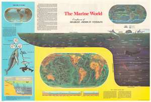
This is a c. 1968 Hammond infographic chart and map celebrating marine exploration. The piece is dominated by a profile cross-section of the sea. It illustrates marine life at various depths, including fish, a shark, a whale, and a giant squid. Dashed lines delineate 'zones', with each falling within the neritic or the oceanic province. Three world maps and other ocean related diagrams occupy the rest of the sheet. The largest is a map submarine topography, likely drawn from the research of Marie Tharp. Below, profile views of the floor of the Pacific Ocean and Atlantic Ocean are included. The second map, in the upper right, details currents. The third and final map, in the upper left, highlights commercial fishing areas, other general fisheries, and whaling areas. Diagrams along the left present information about oceanic life cycles and part of the oceanic food chain. (more details)