1946 Schmidt Pictorial Tourist Map of Colorado
ColorfulColorado-schmidt-1946$400.00


Title
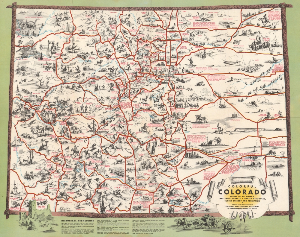
Colorful Colorado Offers to All America Healthful Climate, Varied Resources, Superb Scenery and Recreation.
1946 (dated) 16.5 x 20.75 in (41.91 x 52.705 cm)
1946 (dated) 16.5 x 20.75 in (41.91 x 52.705 cm)
Description
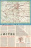
This is a charming 1946 Ray Schmidt pictorial tourist map of Colorado, issued to promote tourism.
A Closer Look
Coverage embraces all of Colorado, with illustrative vignettes populating the state. Cities and towns are labeled, including Denver (complete with an illustration of the state capitol building), Colorado Springs, Pueblo, Durango, and Grand Junction. Since the Rocky Mountains divide the state, numerous peaks and mountain passes are noted, with names and elevations. A charming illustration of Cliff House at Mesa Verde National Park adorns the lower-left, while a large sauropod marks Dinosaur National Monument at the upper left. Colorado wildlife, including bighorn sheep, deer, elk, beaver, and pheasant, add charm. Schmidt also expertly blends the old with the new, juxtaposing planes, futuristic trains, and cars with cowboys, prospectors, and rodeos. Colorado's wild west heritage is evoked by including covered wagons and a stagecoach. The whole is surrounded by a frame that evokes the imagery of a stretcher used for drying animal hides, completing the aesthetic.Other Content
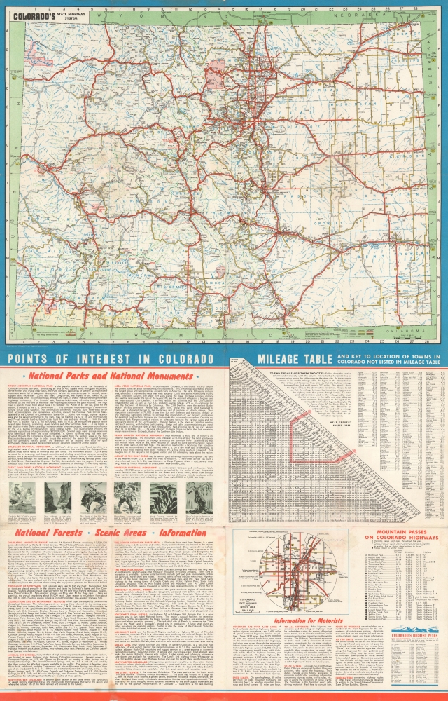
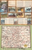
Printed color photographs of Pikes Peak, Mesa Verde, and Glenwood Canyon appear above the map on the recto. A highway map of Colorado and a distance chart occupy most of the verso. The rest of the verso provides driving information for motorists and on Colorado's parks, national monuments, museums, and other sites.Publication History and Census
This map was created by Ray Schmidt and published by the Bradford-Robinson Printing Company in 1946 for the Colorado State Highway Department. At least two previous editions were published: one in 1943 that was meant as a souvenir and one in 1941 that the Bradford-Robinson Printing Company also published for the Colorado State Highway Department. The 1941 edition does not include the historical annotations here printed in red, and the 1943 edition does not include the historical notes that appear below the present map. We note 2 examples of the present 1946 edition cataloged in OCLC: Harvard University and the Utah Historical Society.Condition
Good. Closed and repaired tears extending .5 inch within printed area professionally repaired on verso. Measurements reflect pictorial map. Fully unfolded 33.75 x 21.75 inches.
References
OCLC 83219214.