Title
Intercontinental Railway Commission. Report of Corps No. 1. Maps and Profiles.
1898 (undated)
11.5 x 9 in (29.21 x 22.86 cm)
1 : 48000
Description
An incredible piece of never-built history, this is a set of 31 c. 1898 maps spanning from Guatemala through El Salvador, Honduras, Nicaragua, and Costa Rica, highlighting the proposed route for the planned Intercontinental Railroad. First proposed in 1890 after the First International Conference of American States, the Intercontinental Railway was planned to span 10,400 miles and connect New York and Buenos Aires.
A Closer Look
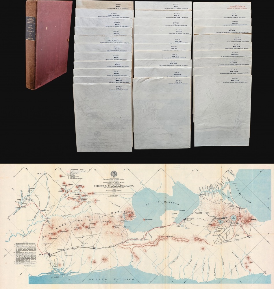
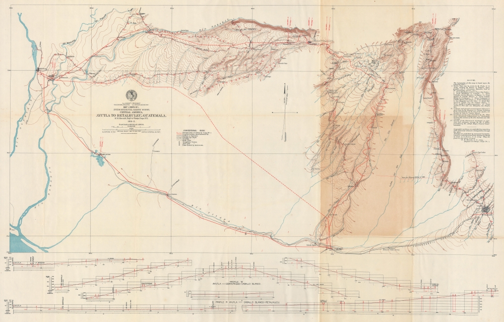
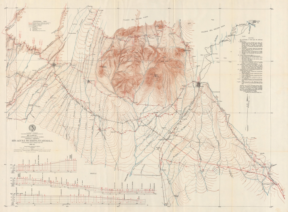
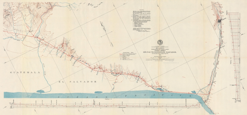
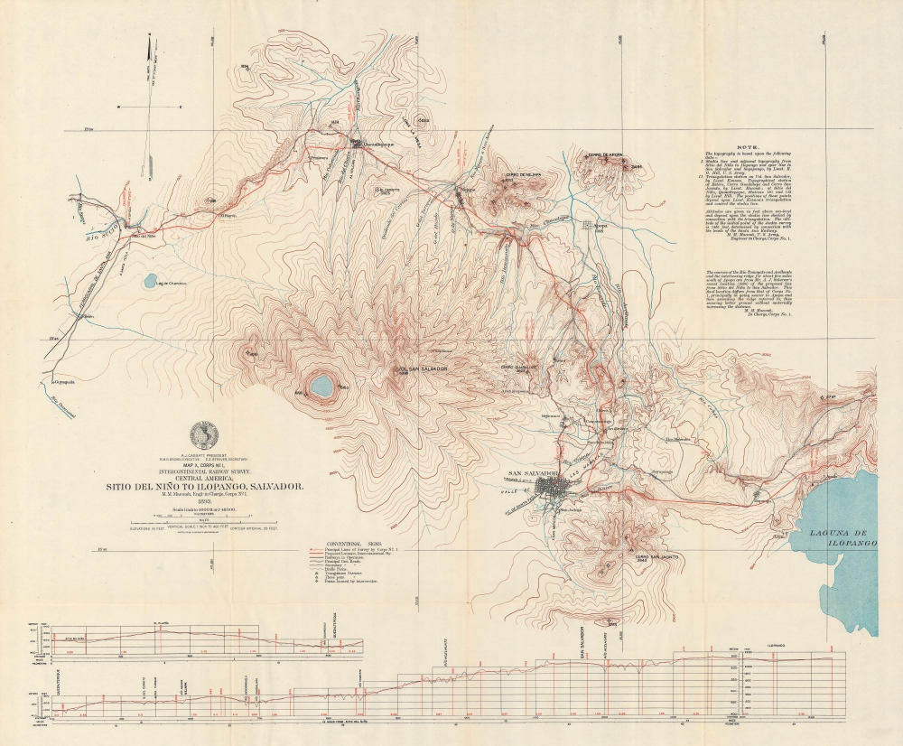
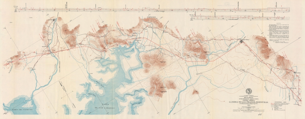
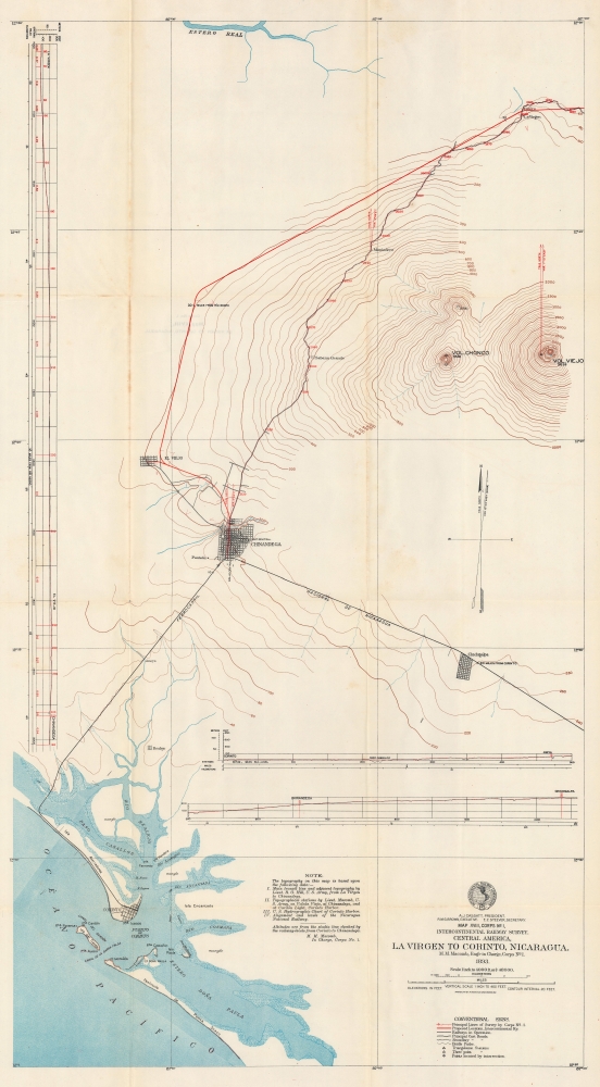
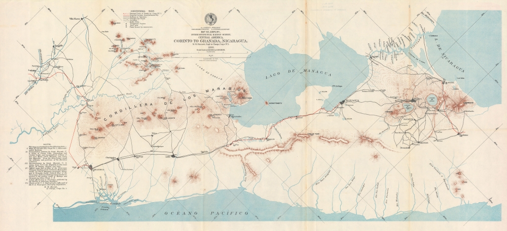
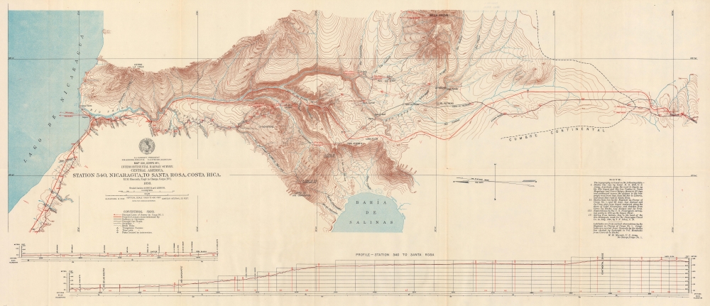
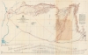
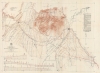
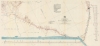
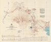
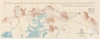
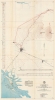
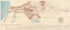
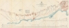
Depicting from Ayutla, Guatemala, to Boca Savegre, Costa Rica, 31 sheets present the routes surveyed by Survey Corps No. 1 from 1891 through 1893 on behalf of the International Railway Commission. Red lines highlight the proposed route. Rivers, lakes, mountains, volcanoes, and other physical features appear, with some sheets noting existing railroads. The sheets vary in dimension and scale, with several over 40 inches in length. The geographical division of the sheets is as follows: 8 maps of Guatemala, 7 maps of El Salvador, 2 of Honduras, 6 of Nicaragua, and 7 of Costa Rica.Corps No. 1, Intercontinental Railway Commission
Seven engineers (6 U.S. Army officers and 1 civilian civil engineer) and 1 army surgeon left New York on April 20, 1891, bound for Guatemala City. They arrived on May 9 and were 'cordially received' by the Guatemalan government. Surveying began on May 31, 1891, and the border with El Salvador was crossed in August 1892. In November 1892 Lieutenant Lyman Walter Vere Kennon was sent to Punta Arenas, Costa Rica, to find the point where the team working south from Costa Rica began, then work northward to meet Macomb and the rest of the team as they continued south.The Intercontinental Railway
First proposed in 1890, the Intercontinental Railroad became the task of the Intercontinental Railway Commission. In theory, the costs of the railroad would be split between governments and private companies, but these plans never came to fruition. Infighting, politics, and the reality of trying to build a 10,000-mile railroad through multiple countries became untenable. The final nail in its coffin was a push for a 'Three Americas Highway' and the advent of affordable private automobiles. As of 1940, 2,990 miles remained unfinished, with the bulk between Panama and Puno, Peru.Publication History and Census
These maps were created for the Intercontinental Railway Commission from surveys undertaken between 1891 and 1893 by teams of surveyors under the direction of Montgomery Meigs Macomb and Lyman Walter Vere Kennon. They were photolithographed by August Hoen and Company c. 1898. We note five examples of this set of maps cataloged in OCLC: Library of Congress, Pennsylvania State University, the University of Oklahoma, Brigham Young University, and the University of Oregon.
Cartographer
August Hoen and Company (fl. c. 1840 - 1981) was a Baltimore based engraving and lithography firm active in the middle part of the 19th century. A. Hoen & Co. was originally founded by Edward Weber under the name 'E. Weber & Company. Weber died in the early 1850s and his company was taken over by German immigrant August Hoen (18?? - 1886) and his brothers, Henry and Ernest Hoen. As general interest lithographers, the Hoen firm's corpus includes posters, cigar boxes, sheet music covers, and posters as well as maps. They are best known for their pioneering multi-color lithographic techniques. After the death of August Hoen, the business passed on to his son, Albert Hoen. Another son, Earnest A. Hoen, moved to Richmond, Virginia and opened a branch of the firm there where he was granted a charter to produce Civil War era Confederate Currency. Their contributions to the cartographic field are generally in association with engraving and printing work done for Jacob Monk and the U.S. Geological Survey. The Hoen family maintained an active interest in the firm for the next 100 years or so until it finally filed for bankruptcy in 1981. More by this mapmaker...
Condition
Good. 31 maps in wrapped cardboard slipcase. Wear along fold lines of all maps. Only a few maps have some loss at fold intersections or along fold lines. Scales and sizes of maps vary. Dimensions given are for all maps in slipcase. Slipcase in average condition. Map III, Altos Line. Huehuetenango to Quezaltenango, Guatemala not present.
References
OCLC 11316615. Castro, J.J., Treatise on the South American Railways and the Great International Lines Published Under the Auspices of the Ministry of Foment of the Oriental Republic of Uruguay and Sent to the World's Exhibition at Chicago, (Montevideo: La Nación) 1893. Kaler, J.J., The Intercontinental Railroad Project. (Unpublished Master's Thesis). Minnesota State University, Mankato. Mankato, Minnesota.