
Hoen, August

August Hoen and Company (fl. c. 1840 - 1981) was a Baltimore based engraving and lithography firm active in the middle part of the 19th century. A. Hoen and Co. was originally founded by Edward Weber under the name 'E. Weber and Company.' Weber died in the early 1850s and his company was taken over by German immigrant August Hoen (18?? - 1886) and his brothers, Henry and Ernest Hoen. As general interest lithographers, the Hoen firm's corpus includes posters, cigar boxes, sheet music covers, and posters as well as maps. They are best known for their pioneering multi-color lithographic techniques. After the death of August Hoen, the business passed on to his son, Albert Hoen. Another son, Earnest A. Hoen, moved to Richmond, Virginia and opened a branch of the firm there where he was granted a charter to produce Civil War era Confederate Currency. Their contributions to the cartographic field are generally in association with engraving and printing work done for Jacob Monk and the U.S. Geological Survey. The Hoen family maintained an active interest in the firm for the next 100 years or so until it finally filed for bankruptcy in 1981.
Intercontinental Railway from Guatemala to Costa Rica.
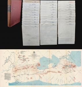
Intercontinental Railway Commission. Report of Corps No. 1. Maps and Profiles.
$950.00
Acquire
- Digital Map Information
- Suitable for large format printing
- Full resolution TIFF file
- ICC color profile embedded
- Delivered instantly via download link
An incredible piece of never-built history, this is a set of 31 c. 1898 maps spanning from Guatemala through El Salvador, Honduras, Nicaragua, and Costa Rica, highlighting the proposed route for the planned Intercontinental Railroad. First proposed in 1890 after the First International Conference of American States, the Intercontinental Railway was planned to span 10,400 miles and connect New York and Buenos Aires. (more details)
On the border with 'Bama.
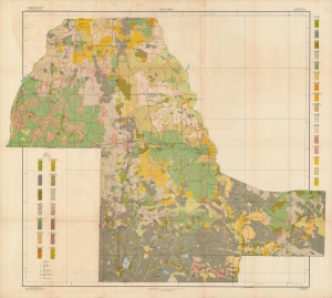
Soil map, Florida, Marianna sheet.
$350.00
Acquire
- Digital Map Information
- Suitable for large format printing
- File Size: 59.25 MB
- File Type: ZIP / TIFF
- ICC color profile embedded
- Delivered instantly via download link
A large-format 1909 soil map of the region around Marianna in Jackson County, Florida, one of the state's northernmost counties. (more details)
Rise of coal mining in Colorado.
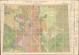
Geologic Map of Colorado.
$950.00
Acquire
- Digital Map Information
- Suitable for large format printing
- File Size: 149.26 MB
- File Type: ZIP / TIFF
- ICC color profile embedded
- Delivered instantly via download link
This is a 1913 Russell D. George geologic map of Colorado. The useful map followed a revival in the Colorado mining industry related to the increasing dominance of coal production. (more details)