1895 City Plan or Map of Dartmouth, Massachusetts
DartmouthMass-unknown-1895$1,900.00

Title
Town of Dartmouth.
1895 (undated) 22 x 32 in (55.88 x 81.28 cm) 1 : 30000
1895 (undated) 22 x 32 in (55.88 x 81.28 cm) 1 : 30000
Description
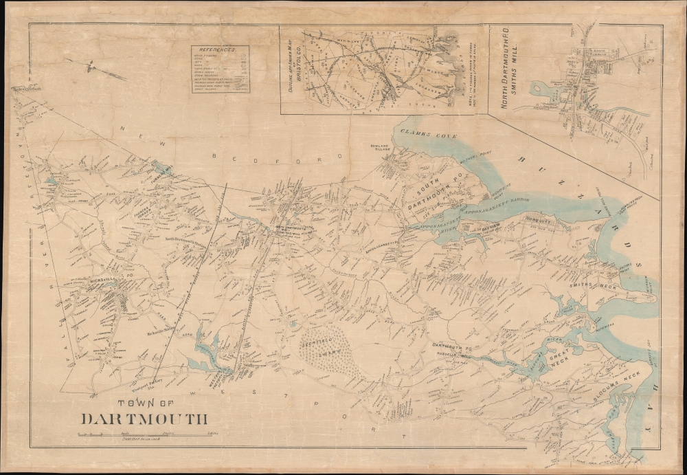
This is a rare separately issued c. 1895 city map of Dartmouth, Massachusetts.
A Closer Look
Oriented toward the east, Dartmouth is bordered by Freetown and Fall River on the left, New Bedford on the top, Westport along the bottom, and Buzzards Bay on the right. Innumerable houses, each bearing the resident's name, appear throughout and line the streets, some of which are unlabeled. Post offices mark several neighborhoods, while others, like Bayview, Nonquitt, Faunces Corner, and Turner's Mill, are identified. Rivers, lakes, bays, points, and other physical features throughout the area are also illustrated. The Fall River Branch of the New York, New Haven, and Hartford Railroad crosses through town, stopping at the Westport Factory Station and the North Dartmouth Station. The electric trolley line between Fall River and New Bedford appears as well and is labeled here as 'Electric Railroad'. It runs just to the south of the Fall River Branch and operated from the mid-1890s until 1935 when the service was replaced by buses.Publication History and Census
As this map is undated and unsigned, we have been unable to trace any other examples. To date the map, we guesstimated based on the presence of the electric railroad between Fall River and New Bedford.Condition
Good. Professional restoration. Mounted on linen. Exhibits some cracking.