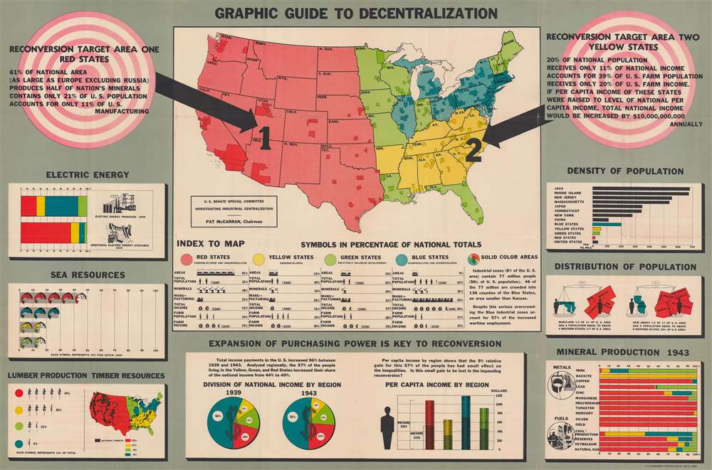
1944 U.S. Senate Committee Map of the United States Industrial Centralization
Decentralization-senate-1944$650.00


Title
Graphic Guide to Decentralization.
1944 (dated) 33.25 x 50.5 in (84.455 x 128.27 cm)
1944 (dated) 33.25 x 50.5 in (84.455 x 128.27 cm)
Description
This is a 1944 map of industrial centralization in the United States created for the U.S. Senate Special Committee Investigating Industrial Centralization. Created near the end of World War II, this map represents government preparations for a post-war United States. Such efforts involved the complex task of reintegrating the rapid industrial expansion instigated by the war into the private-market economy.
A Closer Look
Here, this U.S. Senate committee presents detailed information on industrial distribution. By dividing the country into four 'zones', the committee can present broad but understandable findings. According to the committee, the American West, shaded red, is 'underdeveloped and underpopulated', while parts of the Northeast and Middle West are 'overpopulated and overdeveloped'. The solid color blotches mark 'industrial zones' that 'contain 77 million people' (56% of the population). Within these zones, 46 million people lived in 136 counties in 'Blue States' (the states shaded blue here), which also accounted for fifty-seven percent of increased wartime employment.The Charts
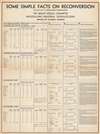
The charts surrounding the map reinforce these findings. The data underscores the diversity of production, with the concentration of manufacturing in the 'Blue States'. Mining, agriculture, and other economic sectors are quantified, but do not compete with manufacturing power.Some Simple Facts on Reconversion
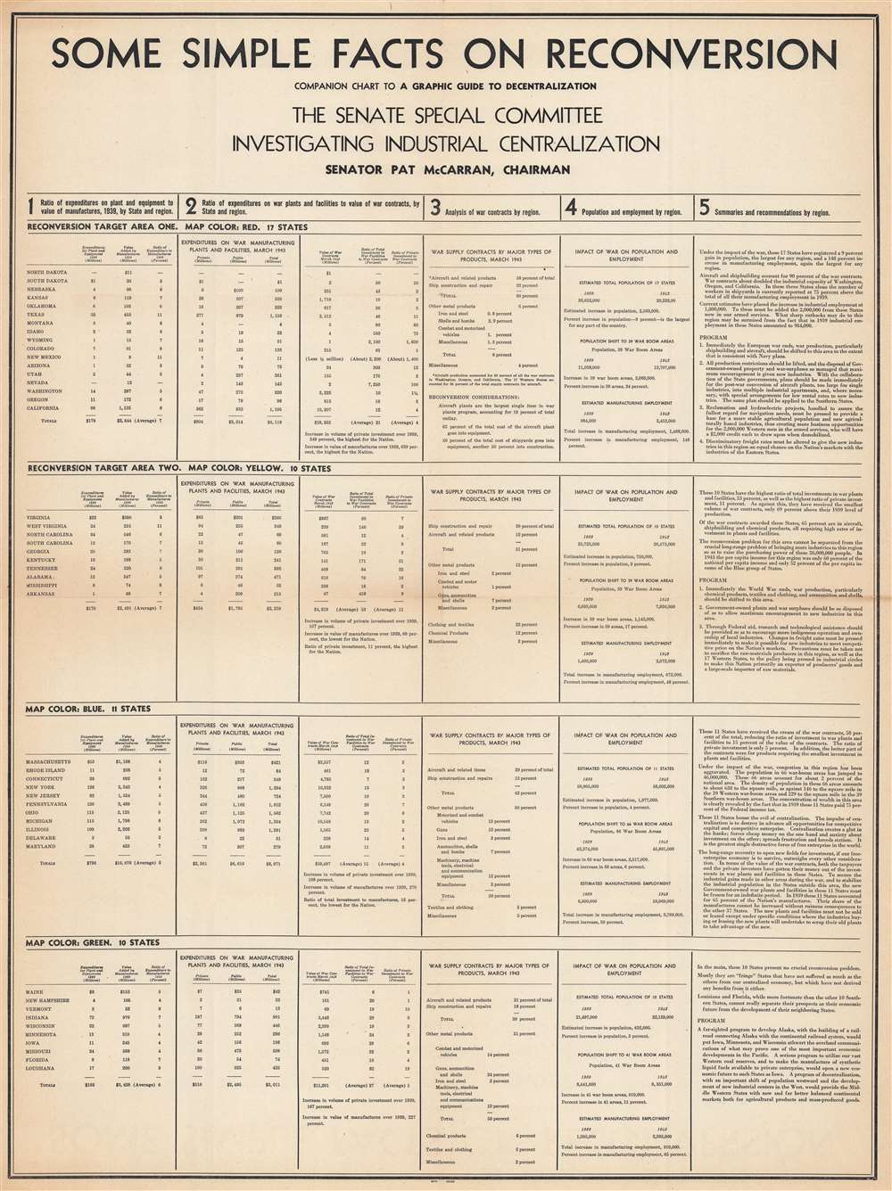
The accompanying chart, entitled 'Some Simple Facts on Reconversion' puts forward the Committee's suggestions for shifting American manufacturing and production to both provide jobs for the returning veterans and promote economic opportunity. These suggestions also take advantage of wartime regional developments and specializations. For example, aircraft manufacturing had been concentrated in Washington, Oregon, and California. The Committee suggested that all aircraft manufacturing be shifted to this region after the war. It also suggested that steps be taken to disperse the manufacturing centralization that developed within the 'Blue States', stating that centralization 'breeds statism'.Publication History and Census
This map was created for the U.S. Senate Special Committee Investigating Industrial Centralization and published by the U.S. Government Printing Office in 1944. We note less than twenty examples cataloged in institutional collections worldwide. It is scarce on the private market.Condition
Good. Closed margin tears professionally repaired on verso. Verso repairs to fold separations. Areas of infill at some fold intersections. Accompanied by 'Some Simple Facts on Reconversion. Companion Chart to A Graphic Guide to Decentralization'.
References
OCLC 83415399.