This copy is copyright protected.
Copyright © 2024 Geographicus Rare Antique Maps
1922 Riedel Map of Fort Wayne, Indiana
FortWayne-riedel-1922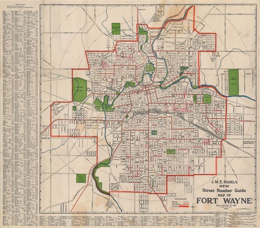

Johann Michael Eric Riedel (December 2, 1865 - February 10, 1948), generally known as 'John', was a German-American architect and mapmaker based in Fort Wayne, Indiana in the late 19th and early 20th centuries. Riedel was born in St. Louis, Missouri to German immigrant parents. His family relocated to Fort Wayne as a child and lived there for most of his life. He began practicing as an architect around 1889, becoming prominent by about 1900. He built several significant structures around the city. Starting in the early 20th century, he also issued a folding pocket map of Fort Wayne, which remained in publication with regular updates at least until 1930. Riedel died of heart problems in 1948. More by this mapmaker...
Copyright © 2024 Geographicus Rare Antique Maps | Geographicus Rare Antique Maps
This copy is copyright protected.
Copyright © 2024 Geographicus Rare Antique Maps