1845 Ewing Map of France in Departments
FranceDept-ewing-1845$100.00

Title
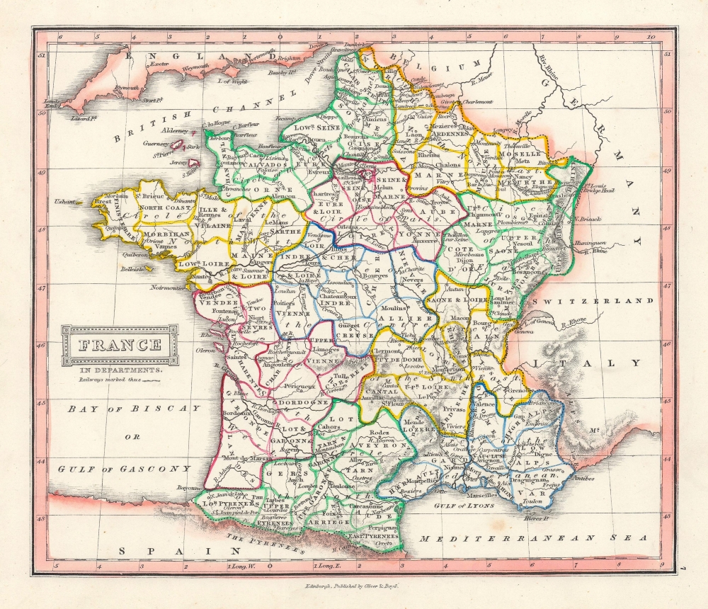
France in Departments.
1845 (undated) 8.5 x 9.5 in (21.59 x 24.13 cm) 1 : 5700000
1845 (undated) 8.5 x 9.5 in (21.59 x 24.13 cm) 1 : 5700000
Description
This is an example of Thomas Ewing's 1845 map of France. The map divides France into its constituent Departments. It covers from the Nord in the north to eastern Pyrenees in the south and from Finistere in the west to Upper and Lower Rhein in the east. Various towns, cities, rivers, roads, railways, mountains and several other topographical details are noted with relief rendered by hachure.
The French Department system was established on March 4th, 1790 by the National Constituent Assembly to replace the provinces with what the Assembly deemed a more rational structure. They were designed to deliberately break up France's historical regions in an attempt to erase cultural differences and build a more homogeneous nation. Initially there were 83 departments but by 1800 that number increased to roughly 130. Many of the departments that were created in 1790 remain the administrative districts to this day. Nonetheless, the province system was so engrained that most cartographers felt obliged to include two maps of France in their atlases, one showing the current department system, and another defining the defunct provinces.
This time in French history marked the rule of the July Monarchy, a liberal constitutional monarchy under King Louis-Philippe. The July Monarchy would last until the Revolution of 1848 and ultimately lead to the establishment of the Second Republic. In less than a year after the December 2, 1851 coup d'etat, the Second Republic transformed into the Second Empire, established by a referendum on November 7, 1852. President Louis-Napoleon Bonaparte, elected by the heavily Bonapartist French people, officially became Napoleon III, Emperor of the French, from the symbolic and historic date of December 2, 1852.
This map was published in 1845 by Oliver and Boyd as part of Ewing's New General Atlas.
Source
Oliver and Boyd, Ewing's New General Atlas: containing Distinct Maps of all the Principal States and Kingdoms throughout the World, (Edinburgh) 1845.
Condition
Very good. Minor foxing at places. Blank on verso.