
This item below is out of stock, but another example (left) is available. To view the available item, click "Details."
Details
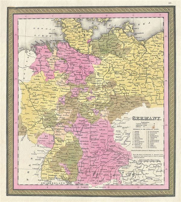
1854 Mitchell Map of Germany
1854 (dated 1850) $150.00
1846 Mitchell Map of Germany
Germany-mitchell-1846$50.00

Title
Germany.
1846 (undated) 13 x 11 in (33.02 x 27.94 cm) 1 : 3250000
1846 (undated) 13 x 11 in (33.02 x 27.94 cm) 1 : 3250000
Description
This is a fine example of S. A. Mitchell's 1846 map of Germany. The whole is engraved in Mitchell's distinctive style with green border work and vivid pastels. Political and topographical features are noted and color coded with elevation rendered by hachure. The map is color coded according to German Federal States with a key referencing the same along the right border.
This map was made in the years following the European Revolutions of 1848. These liberal uprising swept all though Europe, except Russia and the United Kingdom. Germany was particularly affected by the March Revolution of 1848. These revolutions were nationalist pro-German, pan-German, declarations of discontent with the archaic autocratic political structure that dated to the 39 original German states established under the Holy Roman Empire. The years following the violent suppression of the March Revolution saw a vast middle class exodus from the German states to the United States, leading to 'Germantown USA,' and popular interest among Americans in the Fatherland.
This map was prepared by S. A. Mitchell for publication as plate no. 50 in the 1846 edition of Mitchell's New General Atlas.
Cartographer
Samuel Augustus Mitchell (March 20, 1792 - December 20, 1868) began his map publishing career in the early 1830s. Mitchell was born in Bristol, Connecticut. He relocated to Philadelphia in 1821. Having worked as a school teacher and a geographical writer, Mitchell was frustrated with the low quality and inaccuracy of school texts of the period. His first maps were an attempt to rectify this problem. In the next 20 years Mitchell would become the most prominent American map publisher of the mid-19th century. Mitchell worked with prominent engravers J. H. Young, H. S. Tanner, and H. N. Burroughs before attaining the full copyright on his maps in 1847. In 1849 Mitchell either partnered with or sold his plates to Thomas, Cowperthwait and Company who continued to publish the Mitchell's Universal Atlas. By about 1856 most of the Mitchell plates and copyrights were acquired by Charles Desilver who continued to publish the maps, many with modified borders and color schemes, until Mitchell's son, Samuel Augustus Mitchell Junior, entered the picture. In 1859, S.A. Mitchell Jr. purchased most of the plates back from Desilver and introduced his own floral motif border. From 1860 on, he published his own editions of the New General Atlas. The younger Mitchell became as prominent as his father, publishing maps and atlases until 1887, when most of the copyrights were again sold and the Mitchell firm closed its doors for the final time. More by this mapmaker...
Source
Mitchell Jr., S. A., Mitchell's New General Atlas, Containing Maps Of The Various Countries Of The World, Plans Of Cities, Etc. Embraced In Forty-Seven Quarto Maps, Forming A Series Of Seventy-Six Maps And Plans, Together With Valuable Statistical Tables, 1846 edition.
Condition
Very good. Minor spotting.
References
Rumsey 0537.051. Phillips (Atlases) 6103-50.