This item has been sold, but you can get on the Waitlist to be notified if another example becomes available, or purchase a digital scan.
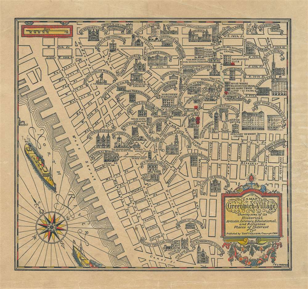
1934 Harper Pictorial Map of Greenwich Village, New York City
GreenwichVillage-harper-1934-2$337.50

Title
A Map of Greenwich Village Showing some of its Historical, Artistic, Literary, Educational, and Religious Places of Interest.
1934 (undated) 9.25 x 10.25 in (23.495 x 26.035 cm) 1 : 8976
1934 (undated) 9.25 x 10.25 in (23.495 x 26.035 cm) 1 : 8976
Description
This is a 1934 E. L. Harper pictorial map of Greenwich Village. The map depicts this New York City neighborhood from the North (Hudson) River to Lafayette Street and from East 14th Street to Canal Street. Highly detailed, each of the streets in the neighborhood is labeled, along with numerous locations illustrated in profile. Nearly two dozen different places of worship are depicted, including Grace Church, the Church of Our Lady of Pompeii, and St. Bernard's Church. New York University and the Washington Mews are also illustrated and labeled, along with Washington Square and the Washington Arch. The original Whitney Museum of American Art is included, as well as the New York Public Library and the entrance to the 'Holland Vehicular Tunnel'.
Publication History
This very charming map was drawn by E. L. Harper and published by The Villager magazine in 1934.Condition
Some toning.
References
Rumsey 11206.000. Brooklyn Public Library, M-1934.Fl.