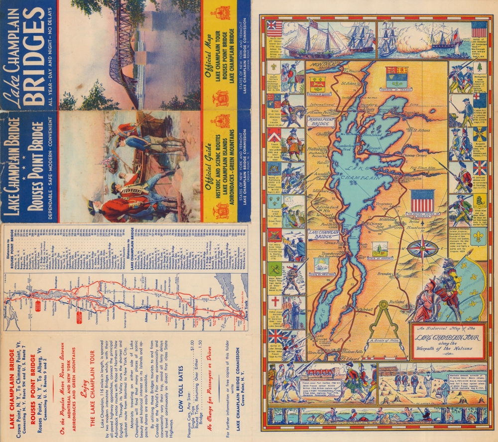
1939 Lake Champlain Bridge Commission Pictorial Map of Lake Champlain and Lake George
HistoricalChamplain-bridgecomm-1939$175.00


Title
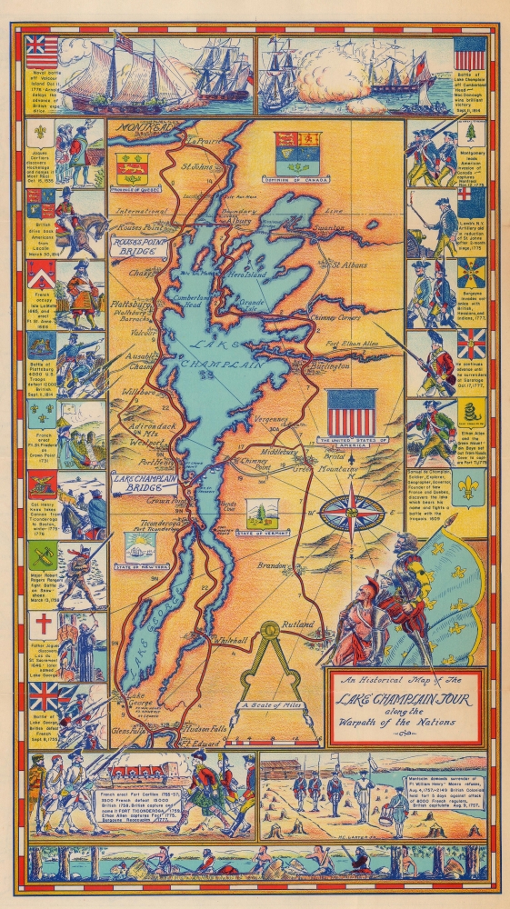
An Historical Map of the Lake Champlain Tour along the Warpath of the Nations.
1939 (dated) 15.25 x 8.5 in (38.735 x 21.59 cm) 1 : 625000
1939 (dated) 15.25 x 8.5 in (38.735 x 21.59 cm) 1 : 625000
Description
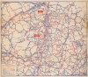
A charming map summarizing the Lake Champlain region's early history. This is a 1939 Lake Champlain Bridge Commission pictorial map of Lake Champlain and Lake George. Pictorial vignettes capture events during the colonial period, the American Revolution, and the War of 1812, while the central map promotes the Bridge Commission's two bridges: the Rouses Point Bridge and the Lake Champlain Bridge.
A Closer Look
Depicting from Montreal south to Fort Edward, towns and villages are labeled all along the banks of Lake Champlain and Lake George: Rouses Point, Ticonderoga, Burlington, Lake George, and Glens Falls. The Rouses Point and the Lake Champlain Bridges are prominently labeled and major roads highlighted. The seals of the United States of America and the Dominion of Canada appear, along with the seals of New York State, Vermont, and the Province of Quebec. Vignettes of historical events create a pictorial border and trace events from the discovery of Montreal by Jacques Cartier in 1535 through the American Revolutionary War (1775 - 1783) to the Battle of Plattsburg and the Battle of Lake Champlain (September 11, 1814).Other Content
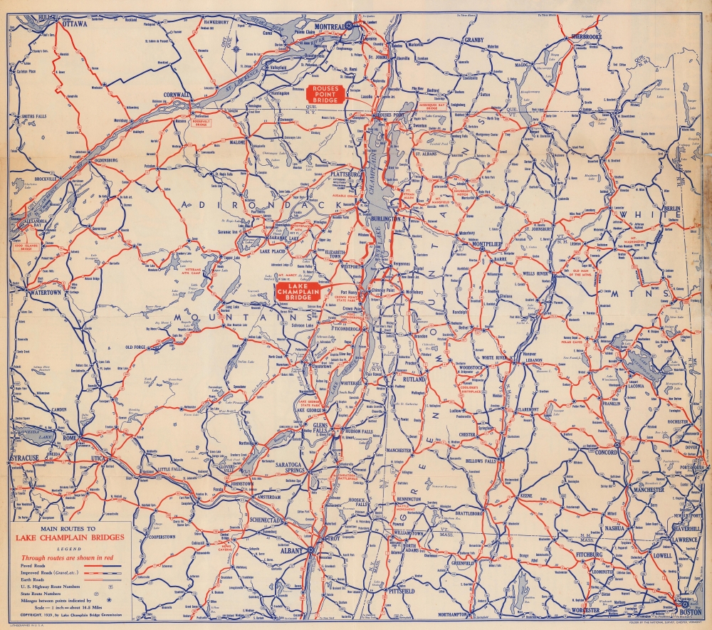
This charming pictorial map occupies half the sheet, with a road map and a table of distances occupying another quarter. A road map of northern New York and Vermont fills the verso.Not Everyone Was Impressed
In an article in the St. Albans Daily Messenger on Saturday, June 17, 1939, the editor of the Newport Express chastised the Lake Champlain Bridge Commission for publishing a distorted map.The latest attempt to map this section as a detour route (passable but unsafe) is found in a highly colored, quasi-historical splurge boosting the so-called 'Champlain bridges'. The 'Champlain bridges', it seems, are at Chimney Point and Rouses Point. There is another unimportant bridge, to be sure, across Missisquoi Bay, but it comes from nowhere, and leads to the same place.
There can be no criticism of the prominence given the two 'Champlain bridges' and the amusing obscurity accorded the Missisquoi Bay bridge on the folder, because it was issued by the Lake Champlain bridge commission as publicity material for the two spans over which it has jurisdiction. There is, however, plenty reason for complaint when, in foisting the Chimney Point and Rouses Point bridges upon the touring public, especial pains is taken on the 'historical' map to indicate the road from Chimney Corner on route 7, through Swanton and St. Albans to the Missisquoi Bay bridge, as an unimportant, secondary highway, while at the same time red-inking route 2 through the Islands as though it were the only paved route.
Route 7, starting at So. Norwalk, Conn., runs straight by the Chimney corner, and straight through to Montreal. It is equally as important, and a more direct north and south artery, than route 2. Why first ferry, and then bridge, interests should be permitted perpetually to relegate route 7 to the status of a secondary road is beyond comprehension. Such distortions put out under the guise of 'official maps' plainly should not be allowed, not only because it is unfair play but more important, they deceive the tourist visitors.
If the historical data decorating the margins of the Lake Champlain Bridge commission map are no more reliable than the road map, there are going to be a lot of misinformed people groping around the state this summer.
Publication History and Census
This map was drawn by H. C. Larter, Jr., and published by the Lake Champlain Bridge Commission in 1939. We note five examples cataloged in OCLC: Pennsylvania State University, the University of Toronto, the University of Georgia, the Newberry Library, and the University of California Los Angeles.Condition
Good. Closed edge tears not effecting map professionally repaired on verso. Road map of northern New York and New Hampshire on verso.
References
OCLC 681762101.