1778 Pockocke / Lindeman Map of the Holy Land, Eastern Mediterranean
HolyLand-pococke-1778$350.00

Title
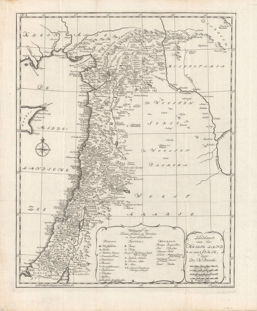
Landkaart van het Heilig Land en van Syrie.
1778 (undated) 18.5 x 15 in (46.99 x 38.1 cm) 1 : 1300000
1778 (undated) 18.5 x 15 in (46.99 x 38.1 cm) 1 : 1300000
Description
A charming map of the Holy Land published in a c. 1778 Dutch translation of Richard Pococke's A Description of the East and Some other Countries, one of the definitive accounts of the region from that era. It displays the lands between the Mediterranean and the Euphrates River, carefully listing both ancient and contemporary settlements.
A Closer Look
Coverage includes nearly the entire eastern coast of the Mediterranean, with the greatest detail between the Gulf of İskenderun and Anthedon, an ancient Greek site now near Gaza City. Mountains, waterways, and settlements (both ancient and contemporary, with the latter in italics) are noted in remarkable detail, along with Pococke's travels, which are traced with a dashed line. The legend includes three categories: symbols (for cities and towns, churches, fortifications, and the like), letters (abbreviations for geographical features, such as 'I.' for island), and a glossary of Arabic words and their Dutch equivalents.Publication History and Census
This map accompanied a Dutch translation of Pococke's work A Description of the East and Some other Countries, which was originally published between 1743 and 1745, then translated into Dutch and published by Johannes Wessing around 1750 as Beschryving Van Het Oosten, En Van Eenige Andere Landen. The present map appeared in a c. 1778 reprint of the Dutch edition and was engraved by Otto Lindeman. This edition of the map is not known to be independently cataloged in any institutional collections and is scarce to the market, while the Dutch edition of Pococke's book is held by 18 institutions worldwide, mostly in Europe.Cartographer
Richard Pococke (November 19, 1704 - September 25, 1765) was an English vicar, traveler, and scholar. He is best known for his works, which combined travelogue and ethnography. Though he travelled throughout the British Isles and Europe, he is best known for his four-year foray into the Muslim world, which was recounted in A Description of the East and Some other Countries, published between 1743 and 1745. More by this mapmaker...
Source
Pococke, R., (Cramerus, E. W., trans.), Beschryving van het Oosten, en van eenige andere landen..., (Utrecht: G.T. en A. van Paddenburg) 1776-78.
Condition
Very good. Light creasing along fold lines. Faint handwriting in margins.