This item has been sold, but you can get on the Waitlist to be notified if another example becomes available, or purchase a digital scan.
1845 Benjamin Map of the Hudson River
HudsonRiver-benjamin-1845$375.00

Title
Benjamin's New Map of the Hudson River.
1845 (dated) 28.5 x 11 in (72.39 x 27.94 cm) 1 : 570240
1845 (dated) 28.5 x 11 in (72.39 x 27.94 cm) 1 : 570240
Description
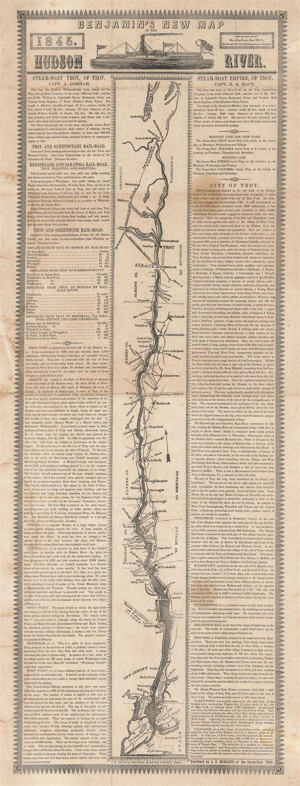
This is an 1845 J.P. Benjamin map of the Hudson River created by the Troy Steam-Boat Company. Coverages extends from Whitehall to Staten Island. Cities and towns are labeled along the river, including Troy, Albany, Hyde Park, Poughkeepsie, West Point, Peekskill, Tarrytown, New York City, and Brooklyn. Counties in New York are also identified, including King's County (Brooklyn). Roads run along both sides of the river and connect every town along its banks. A text situated on both sides of the map details railroad connections available to travelers on the Troy Steam-Boat Company, mileage between points along different routes, and the histories of cities between the Palisades and Troy. A short description of the Steam Boat 'Empire' is provided at the top of the right-hand column, along with a textual timetable.
Publication History and Census
This map was published by J.P. Benjamin and printed by N. Tuttle in 1845. We have found that this map was published in several different editions in the mid-1840s with this being the only known example of the 1845 edition. We note five examples of the 1846 edition cataloged in OCLC which are part of the collections at Columbia University, Princeton University, the Connecticut State Library, Harvard University, and the Newberry Library.Condition
Good. Even overall toning. Exhibits some soiling. Closed tear extending one half inch into printed area from top margin professionally repaired on verso.
References
OCLC 81364526 (1846 edition).