This copy is copyright protected.
Copyright © 2024 Geographicus Rare Antique Maps
1548 Gastaldi Map of the Indian Peninsula
India-gastaldi-1548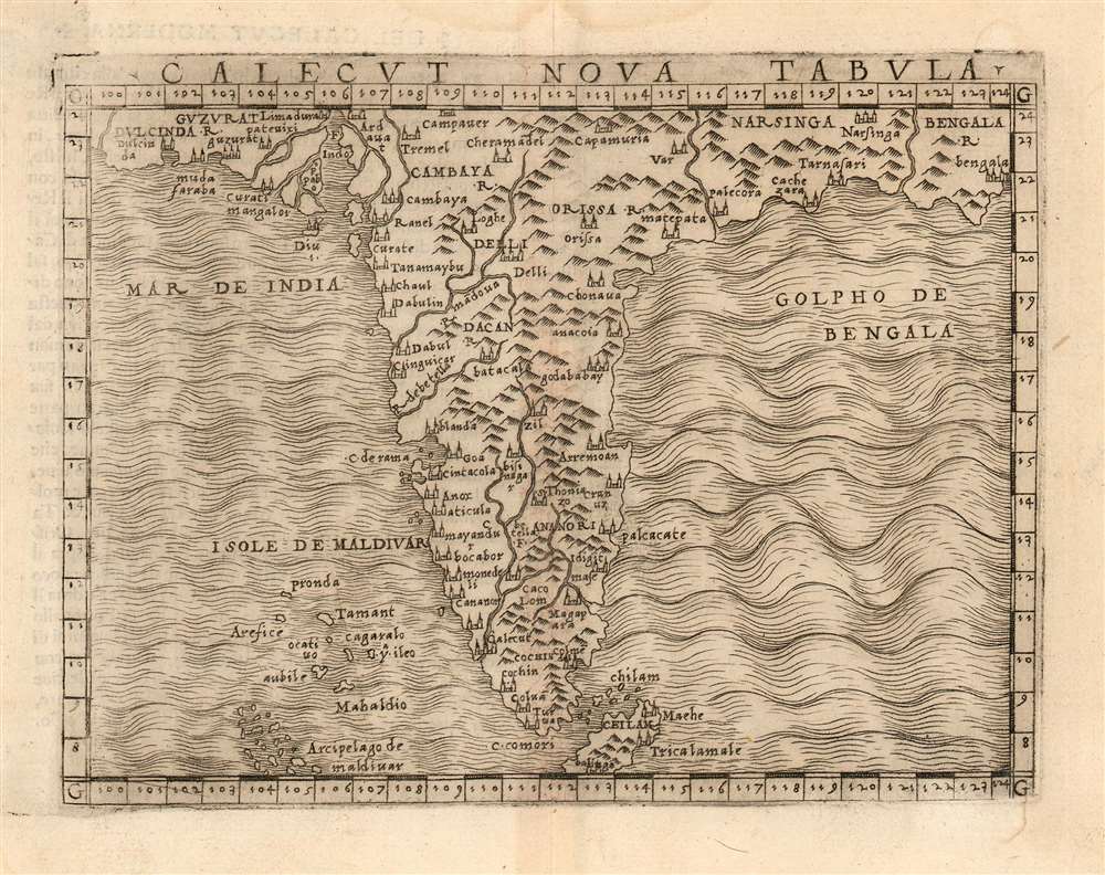

Giocomo Gastaldi (c. 1500 - October, 1566) was an Italian astronomer, cartographer, and engineer active in the second half of the 16th century. Gastaldi (sometimes referred to as Jacopo or Iacobo) began his career as an engineer, serving the Venetian Republic in that capacity until the fourth decade of the sixteenth century. During this time he traveled extensively, building a large library relating to voyages and exploration. From about 1544 he turned his attention to mapmaking, working extensively with Giovanni Battista Ramusio, Nicolo Bascarini, and Giovanbattista Pedrezano, as well ask taking private commission for, among others, Venice's Council of Ten. He is credited with the fresco maps of Asia and Africa still extent in the map room of the Doge's Palace. Gastaldi was also one of the first cartographers to embrace copper plate over woodblock engraving, marking and important development in the history of cartography. His 1548 edition of Ptolemy's Geographia was the first to be printed in a vernacular; it was the first to be printed in copperplate. As with his Swiss/German contemporary Münster, Gastaldi;'s work contained many maps depicting newly discovered regions for the first time, including the first map to focus on the East Coast of North America, and the first modern map of the Indian Peninsula. His works provided the source for the vast majority of the Venetian and Roman map publishers of the 1560s and 70s, and would continue to provide an outsize influence on the early maps of Ortelius, De Jode, and Mercator. More by this mapmaker...
Copyright © 2024 Geographicus Rare Antique Maps | Geographicus Rare Antique Maps
This copy is copyright protected.
Copyright © 2024 Geographicus Rare Antique Maps