1842 Tojo Kindai Edo Woodblock Map of the Izu Islands (Tokyo or Edo)

IzuSevenIslands-tojokindai-1842
$2,000.00
伊豆七島全圖 附無人島八十嶼圖相武房總海岸圖 / The Complete Map of the Seven Islands of Izu with a Map of the Eighty Uninhabited Islands. - Main View
Processing...

1842 Tojo Kindai Edo Woodblock Map of the Izu Islands (Tokyo or Edo)

IzuSevenIslands-tojokindai-1842

Early Japanese nautical chart.
$2,000.00

Title


伊豆七島全圖 附無人島八十嶼圖相武房總海岸圖 / The Complete Map of the Seven Islands of Izu with a Map of the Eighty Uninhabited Islands.
  1842 (undated)     30 x 41.5 in (76.2 x 105.41 cm)

Description


An extraordinary find, this is an 1842 (Tenpō 13) Tokugawa Period Japanese woodblock nautical chart / map of the Izu Islands (伊豆諸島 / Izu-shoto) by Tōjō Kindai. Oriented to the East, this map covers from Chiba, Kanagawa, and Sagami Bay southwards as far as Miyake and Mikurajima Islands. With minimal inland detail this map can best be interpreted as a traditional Japanese nautical chart. Notes nautical routes and many offshore features including dangerous reefs and shoals.
Izu Seven
Traditionally referred to as the 'Izu Seven' (伊豆七島 / Izu Shichito), the Izu Islands are officially part of modern-day Tokyo. Though many are uninhabited nature preserves, some of the Izu Islands host large towns and villages. This map notes the locations of various shrines, towns, rivers, and temples, and identifies local production specialties. With minimal inland detail this map can best be interpreted as a traditional Japanese nautical chart. Notes nautical routes and many offshore features including dangerous reefs and shoals.
Publication History and Census
This map was drafted by Tōjō Kindai. According to the Library of Congress, 500 examples were printed in 1842. We note an example as the University of California, Berkeley, East Asian Library. There are likely others in Japanese library collections. Rare.

Cartographer


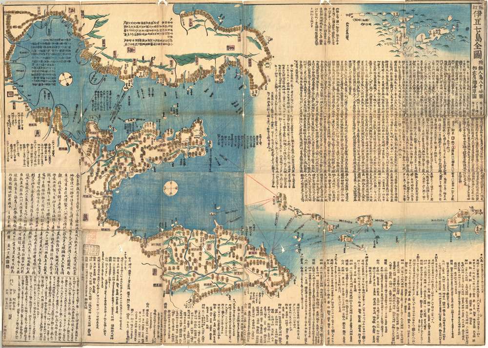
Tojo Kindai (東条琴台; July 22, 1795 - September 26, 1878) was a Japanese Confucian scholar and cartographer active in Edo during the middle part of the 19th century. He was born in Edo (Tokyo) and studied under Ota Kinjo (大田 錦城; 1765 - 1825) and Kameda Pengsai (亀田 鵬斎; 1752 - 1826), later serving the Fukushima Daimyo. Tojo's work transitions between the Edo and early Meiji periods. More by this mapmaker...

Condition


Very good. Some fold splits exhibit verso repairs. Folds into original paper binder.

References


University of California Berkeley, East Asian Library, D143.