This is a 1905 Union Printing Company map of the Lewis and Clark Centennial Exposition in Portland, Oregon. The fair was a major commercial and cultural success, credited with a 100K boost in Portland's population in the five years following.
A Closer Look
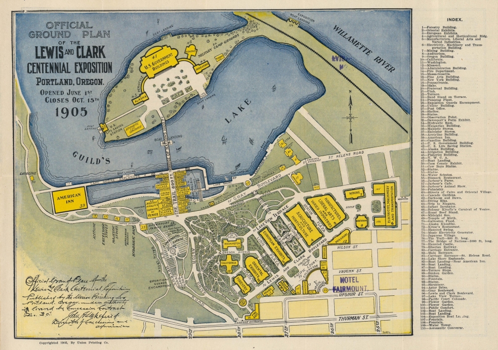
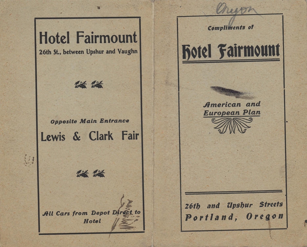
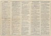
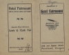
Depicting the entire fairgrounds, including the artificial island built in Guild's Lake, exposition buildings are highlighted in bright yellow and labeled. Among the identified buildings are the U.S. Government Building, the Aeronautic Concourse, and the fisheries and irrigation halls. Many foreign pavilions line 'The Trail', which connects to the 'Bridge of Nations' across Guld's Lake. An index of 110 locations appears outside the right border and lists all the buildings and other attractions that may interest a visitor. A stamp in the lower right quadrant marks the Hotel Fairmount, which distributed the present example of this map. The Hotel Fairmount was built for the exposition across from the fair's main gate and still stands in Portland. It is now on the National Register of Historic Places.The Lewis and Clark Exposition
The Lewis and Clark Centennial Exposition (its official name was the Lewis and Clark Centennial and American Pacific Exposition and Oriental Fair) took place from June 1 - October 15, 1905, in Portland, Oregon. Olmsted Brothers designed the fairgrounds on an artificial island on Guild Lake. Temporary buildings were constructed and lit with over 100,000 light bulbs. Twenty-one nations and 16 U.S. states built exhibits, along with the Smithsonian Institution and the Mormon Tabernacle Choir. 1.6 million people visited the fair, a daily average of 11,600. The fair was also profitable, making a gross profit of nearly $85,000. Portland also experienced a population boom in the wake of the air, with the city's population growing from 161,000 to 270,000 between 1905 and 1910.Publication History and Census
This map was published by the Union Printing Company and distributed by the Hotel Fairmount in 1905. We note two cataloged examples: the University of Washington and the University of Oregon. No record on the private market.
Cartographer
The Union Printing Company (1898 - c. 1995) was a printing company founded in Portland, Oregon. It was incorporated in 1902, and by 1905, Charles S. Beard had become its president and held that position until 1952. In 1910, the company changed its name to the Union Printing. Binding and Stationary Company after three other printers, John E. Impy of the Pacific Bindery Works, W. B. Phillips of the Bellingham Printing Company, and Harry B. Selby (who owned a lineotype machine housed in the Bellingham Printing Company), joined Beard and his business partner Templin. Soon after the merger, the company began advertising as the 'largest printing and binding concern in the Northwest'. The name was changed back to Union Printing Company in 1926. We know the company was operating in the mid-199ss, but we have yet to find a definitive answer as to when or if it ceased operations. More by this mapmaker...
Very good. Light wear along original fold lines. Verso repairs to two fold separations. Text on verso.
OCLC 641677003.