1924 Clason City Plan or Map of Los Angeles, California
LosAngeles-clason-1924$225.00

Title
Map of Los Angeles and Vicinity Compliments of Bank of Italy.
1924 (dated) 27.5 x 21 in (69.85 x 53.34 cm)
1924 (dated) 27.5 x 21 in (69.85 x 53.34 cm)
Description
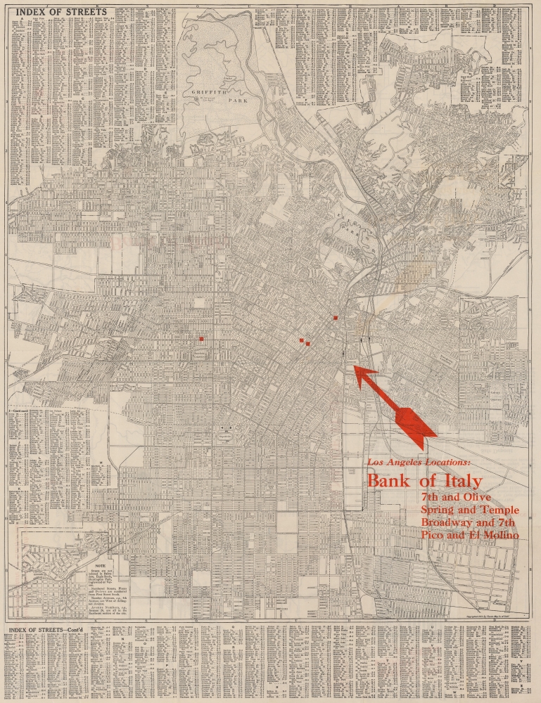
This is a 1924 Clason Map Company city plan or map of Los Angeles, California, issued for the Bank of Italy. Depicting from Griffith Park to Iowa Avenue and from Holt Street to the Flood Control Channel, streets throughout are labeled. Red overprinting highlights the four Bank of Italy branches in Los Angeles and red text provides the cross streets where each branch is located. A street index occupies both upper corners and the entire section below the border.
Verso Content
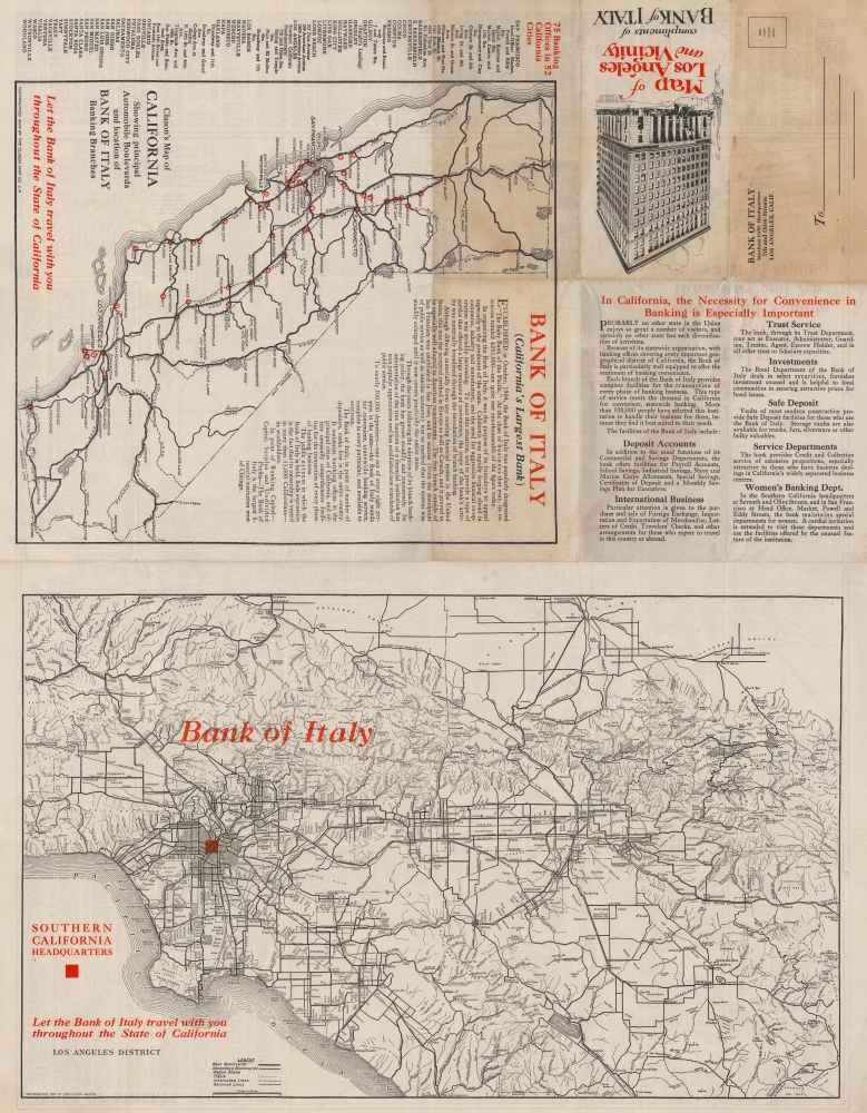
Two maps appear on the verso. One marks the location of every Bank of Italy branch by city. The larger of the two maps focuses on the greater Los Angeles area with red overprinting highlighting downtown Los Angeles where the Southern California Headquarters of the Bank of Italy was located.Publication History and Census
This map was created and published by the Clason Map Company in 1924 and distributed by the Bank of Italy. We note one other cataloged example in private hands.Cartographer
George Samuel Clason (November 7, 1874 - 1957) was born in the city of Louisiana, Missouri in 1874. As a young man, Clason studied at the University of Nebraska before joining the United States Army in 1898 to fight in the Spanish American War. After the war, he moved to Denver, Colorado where in 1905 he founded the Clason Map Company, thus starting his lucrative publishing career. Clason initially focused on mining and mineral maps - capitalizing on the Colorado and Nevada mining industry, but quickly transitioned to railroad maps, city maps, and by the 1920s, road maps. As the company expanded, Clason opened a secondary office in Chicago, Illinois - then a rising map publishing center and railroad hub. At least one other satellite office was opened in Los Angeles. Among his many achievements, Clason is credited with producing the first modern road atlas of the United States. In the late 1920s, Clason also published a series of get-rich-quick pamphlets in the form of parables. The most famous of these is The Richest Man in Babylon. This tells the story of Arkad, a citizen of Babylon famed for his great wealth and generosity who shares his wit and wisdom with his fellow Babylonians. In 1949, Clason moved to Napa, California to retire and found a social club for retired gentlemen. More by this mapmaker...
Condition
Good. Wear along original fold lines. Edge wear. Closed margin tears professionally repaired on verso. Small areas of loss at a few fold intersections.