1948 Department of Mines Pictorial Map of the Province of Manitoba
Manitoba-mines-1948$250.00

Title
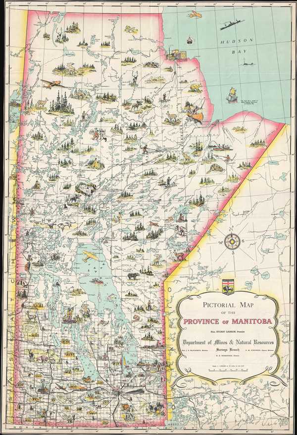
Pictorial Map of the Province of Manitoba.
1948 (undated) 27.25 x 18.5 in (69.215 x 46.99 cm) 1 : 1900800
1948 (undated) 27.25 x 18.5 in (69.215 x 46.99 cm) 1 : 1900800
Description
This is a c. 1948 Surveys Branch of the Department of Mines and Natural Resources pictorial map of the Canadian province of Manitoba. The map depicts the province from Saskatchewan to Ontario and Hudson Bay and from Nunavut and Hudson Bay to Minnesota and North Dakota. Charmingly illustrated, vignettes of Canadian wildlife, buildings, and outdoor activities populate the entirety of the province. Noose, bears, geese, bison, and other wildlife are illustrated, along with mines and factories. Canadians are pictured fishing, canoeing, sailing, hunting, and trapping, and modern transportation methods, like airplanes, trains, and cars, are also shown. Myriad lakes and rivers are included as well, such as Lake Winnipeg, Lake Manitoba, and Lake Winnipegosis. The road network snakes its way through the southern portion of the province, mostly emanating from Winnipeg, but the roads do not reach much farther north than the 53rd parallel. The Half Moon, Henry Hudson's ship, is pictured in Hudson Bay, alongside a whale and a modern ship. The seal of the Province of Manitoba is situated above the title cartouche along the right side.
This map was produced by the Surveys Branch of the Department of Mines and Natural Resources and published c. 1948.
This map was produced by the Surveys Branch of the Department of Mines and Natural Resources and published c. 1948.
Condition
Very good. Even overall toning. No margins. Blank on verso.
References
OCLC 495065092.