1931 Tourism Brochure of Miami and Miami Beach Florida (Features 3 Maps)
MiamiMiamiBeach-unknown-1931$350.00


Title
Miami Miami Beach.
1931 (undated) 14.75 x 8 in (37.465 x 20.32 cm)
1931 (undated) 14.75 x 8 in (37.465 x 20.32 cm)
Description
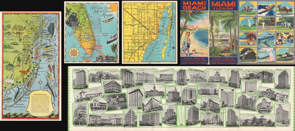
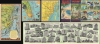
This is a c. 1931 Miami and Miami Beach tourism brochure/booklet featuring pictorail maps by Richard V. Brown, Anthony J. Ziesler, and the Walton and Spencer Company.
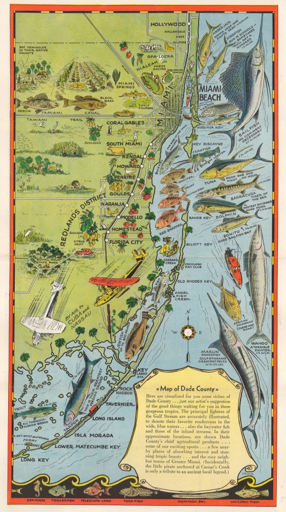
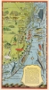
The second map one encounters when leafing through this brochure is on the verso of the 31-inch-long centerfold fold-out. Composed by Anthony J. Ziesler and entitled 'Map of Dade County,' the map features striking illustrations of Miami's many fish species in the Atlantic Ocean. These range from sailfish and marlin to tuna, tarpon, and red snapper. Ziesler includes some short commentary about most of the fish species along with weight ranges. On the mainland, Ziesler illustrates Miami and Miami Beach and marks stops farther south on the Florida East Coast Railway as it heads to Key West. He also labels the Tamiami Canal and Trail and Royal Palm State Park.
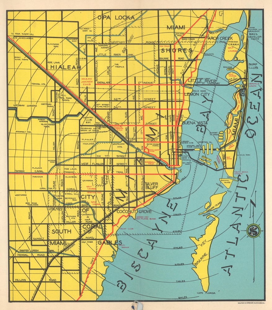
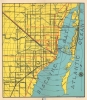
This brilliant brochure's third and final map is a city plan or map of Miami and Miami Beach. Major roads are illustrated throughout both cities as well as in surrounding towns. The Florida East Coast Railway is highlighted. The Venetian Islands, Palm Island, Star Island, and Palm Island are illustrated.
A Closer Look
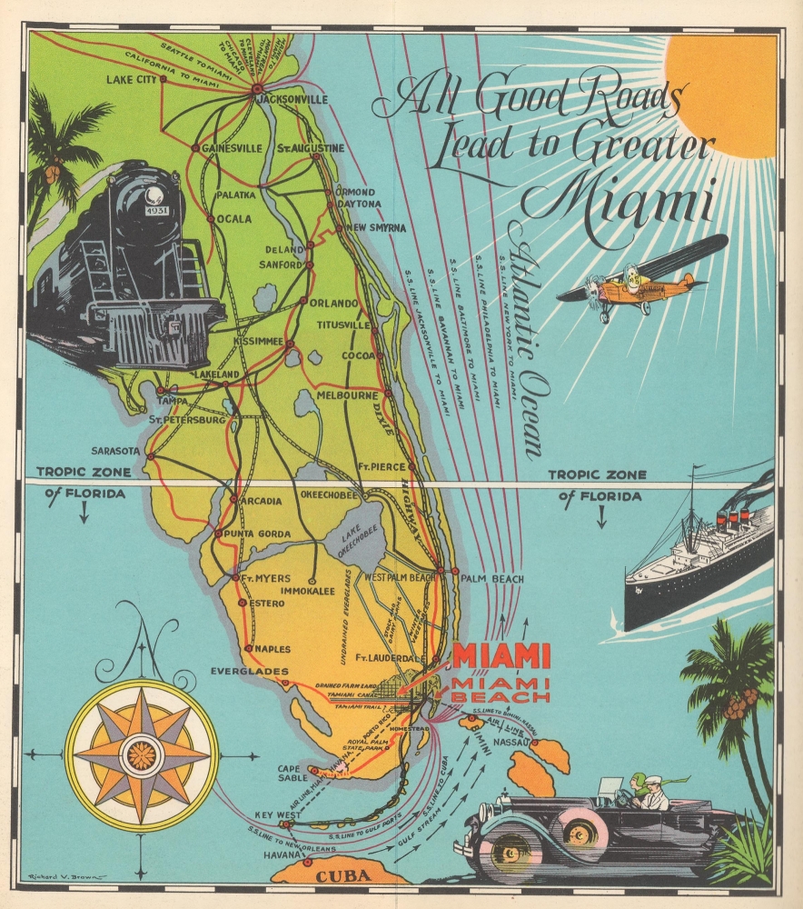
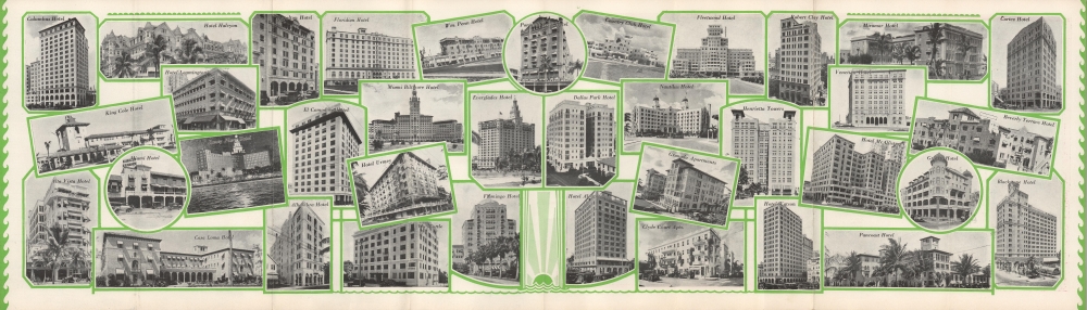
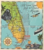
The booklet features 3 maps along with printed photographs and detailed information about Miami and Miami Beach. The first map in the booklet is the map by Richard V. Brown entitled 'All Good Roads Lead to Greater Miami.' Brown highlights highways, railroads, and steamship routes throughout Florida and along the Atlantic Seaboard that terminate in Miami. Seven steamship routes make their way to Miami and depart from New York, Philadelphia, Baltimore, Savannah, Jacksonville, New Orleans, and Cuba. In Brown's depiction, the railroads and highways all enter Florida through Jacksonville, arriving from places throughout the United States and Canada.The second map one encounters when leafing through this brochure is on the verso of the 31-inch-long centerfold fold-out. Composed by Anthony J. Ziesler and entitled 'Map of Dade County,' the map features striking illustrations of Miami's many fish species in the Atlantic Ocean. These range from sailfish and marlin to tuna, tarpon, and red snapper. Ziesler includes some short commentary about most of the fish species along with weight ranges. On the mainland, Ziesler illustrates Miami and Miami Beach and marks stops farther south on the Florida East Coast Railway as it heads to Key West. He also labels the Tamiami Canal and Trail and Royal Palm State Park.
This brilliant brochure's third and final map is a city plan or map of Miami and Miami Beach. Major roads are illustrated throughout both cities as well as in surrounding towns. The Florida East Coast Railway is highlighted. The Venetian Islands, Palm Island, Star Island, and Palm Island are illustrated.
Publication History and Census
This brochure was published by an unknown governmental agency c. 1931. We note a single cataloged example, which is part of the collection of the Touchton Map Library at the Tamp Bay History Center. The Touchton Map Library has also digitized the entire booklet.CartographerS
Richard V. 'Dick' Brown (c.1889 - July 30, 1962) was an American commercial artist. Born in Illinois, Brown arrived in Miami in 1926 from Biloxi, Mississippi. In 1929 he was the director of the Loomis, Bevis, and Hall, Inc., art department where he produced all the interior artwork for the 1929 Miami tourism booklet. He worked with the Parker Art Printing Company as an artist and salesman for 12 years. He served as the co-publisher of the Guest Book and the Miami Visitor-s magazines and as the art director of the Service Engraving Company. He worked as the assistant editorial cartoonist for the Miami Herald during World War II. He was survived by his wife Marian Comber and their son Thomas. More by this mapmaker...
Anthony Joseph Ziesler (May 24, 1879 - December 18, 1962) was a German-American commercial artist. Born in Bavaria, Ziesler's family immigrated to the United States in 1882 when Ziesler was 3. The family settled in Chicago where Ziesler married Magdalen Kohnen in 1906. The couple moved to Miami around 1919 or 1920 where Ziesler worked for The Miami Herald, The Miami News, and the Franklin Press. He and Magdalen had one son and two daughters. Learn More...
Condition
Good. Wear along original folds. Centerfold loose from staples. Slight loss to back cover.
References
Touchton Map Library, Tampa Bay History Center L2019.065.015.